Approximate Location Map
Large Map »
Latitude: 52.7001 / 52°42'0"N
Longitude: -1.0757 / 1°4'32"W
OS Eastings: 462556
OS Northings: 311777
OS Grid: SK625117
Mapcode National: GBR 9N2.QTY
Mapcode Global: WHFK9.FDZD
Plus Code: 9C4WPW2F+2P
Entry Name: 57, High Street
Listing Date: 9 October 1984
Grade: II
Source: Historic England
Source ID: 1074465
English Heritage Legacy ID: 189576
ID on this website: 101074465
Location: Syston, Charnwood, Leicestershire, LE7
County: Leicestershire
District: Charnwood
Civil Parish: Syston
Built-Up Area: Syston
Traditional County: Leicestershire
Lieutenancy Area (Ceremonial County): Leicestershire
Church of England Parish: Syston
Church of England Diocese: Leicester
Tagged with: Building Thatched cottage
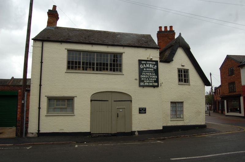
SYSTON
SK 6211 HIGH STREET (South Side)
9/110 No. 57
GV II
House, probably with core of early C17. Rought cast render over a timber
frame on a plinth. Thatched roof. 1½ storeys and three unit plan with one
bay to right of doorway with a 3-light horizontally sliding sash window.
Door in moulded wood architrave. Two 3-light casement windows left of it
with small panes and upper central opening light. One 2-light casement beyond
and two others in the gable wall. Two pilaster buttresses in the front elevation
and two eyebrow dormers with 2-light casement windows. Barge boards to gable.
Various stud partitions etc. and chamfered spine beam within. Gable and axial
stacks.
Listing NGR: SK6255611777
External links are from the relevant listing authority and, where applicable, Wikidata. Wikidata IDs may be related buildings as well as this specific building. If you want to add or update a link, you will need to do so by editing the Wikidata entry.


Other nearby listed buildings
