Approximate Location Map
Large Map »
Latitude: 51.1445 / 51°8'40"N
Longitude: 0.3404 / 0°20'25"E
OS Eastings: 563806
OS Northings: 140962
OS Grid: TQ638409
Mapcode National: GBR NR6.2XF
Mapcode Global: VHHQF.VHBH
Plus Code: 9F3248VR+Q5
Entry Name: Mays Farmhouse
Listing Date: 24 August 1990
Grade: II
Source: Historic England
Source ID: 1074940
English Heritage Legacy ID: 438450
ID on this website: 101074940
Location: Romford, Tunbridge Wells, Kent, TN2
County: Kent
District: Tunbridge Wells
Civil Parish: Pembury
Built-Up Area: Pembury
Traditional County: Kent
Lieutenancy Area (Ceremonial County): Kent
Church of England Parish: Pembury St Peter
Church of England Diocese: Rochester
Tagged with: Farmhouse
TQ 64 SW PEMBURY ROMFORD ROAD
5/420 Mays Farmhouse
GV II
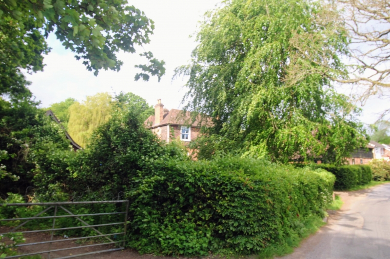
Former farmhouse. Probably C16 origins, refurbished in the late C17, extended
and enlarged in the late C19. Original section is timber-framed but most is
underbuilt with red brick. Framing above is tile-hung. Newer section built
in same style. Brick stacks and chimneyshafts. Peg-tile roof.
Plan: Double depth house facing north east. It is 2 rooms wide. Front rooms
with end stacks and central entrance hall containing the main stair. Rear
block contains former kitchen and service room. Larger rear room, former
kitchen/present dining room, has axial stack backing onto unheated service
room (now used as the kitchen).
The front block is a late C19 addition in front of a late C17 2-room plan
house, apparently built inside the shell of a probably C16 house. It was
difficult at the time of this survey, to determine the layout of the earlier
house, even to determine whether or not it was originally floored. However
there was some evidence to suggest that the existing late C17 stack replaced a
framed smoke bay.
Exterior: Late C19 symmetrical 2-window front of 4-pane sashes, low brick
segmental arches over the ground floor windows. Central front doorway
contains a part-glazed 4-panel door behind a gabled porch on plain posts.
Roof is hipped both ends. The rear block, the older section, has C19 and C20
casement windows ands its taller roof is hipped both ends.
Interior: The rear block is the historic core and here a great deal of early
carpentry remains. All the main beams and some of the joists are plain
chamfered, those over the former service room/present kitchen are of
relatively large scantling. Former kitchen fireplace relined with C20 brick
but its chamfered oak lintel is probably original, that is to say late C17.
Evidence for the C16 house is difficult to distinguish below roof level. The
wall plate and tie beams are lower than attic level suggesting that the attic
floor was inserted in the late C17 into the earlier roof. Roof itself is
carried on common rafter couples with evidence for lap-jointed collars. The
rafters are clean, except for those in the bay containing the present stack.
Here they are blackened. This with evidence below of timbers incorporated
into the brick stack provide evidence of the framed smoke bay.
Listing NGR: TQ6380640962
External links are from the relevant listing authority and, where applicable, Wikidata. Wikidata IDs may be related buildings as well as this specific building. If you want to add or update a link, you will need to do so by editing the Wikidata entry.


Other nearby listed buildings
