Latitude: 52.7997 / 52°47'59"N
Longitude: -0.9263 / 0°55'34"W
OS Eastings: 472489
OS Northings: 323004
OS Grid: SK724230
Mapcode National: GBR BNG.DN5
Mapcode Global: WHFJS.RW3J
Plus Code: 9C4XQ3XF+VF
Entry Name: Well Head
Listing Date: 1 January 1968
Grade: II
Source: Historic England
Source ID: 1075109
English Heritage Legacy ID: 189969
ID on this website: 101075109
Location: Ab Kettleby, Melton, Leicestershire, LE14
County: Leicestershire
District: Melton
Civil Parish: Ab Kettleby
Traditional County: Leicestershire
Lieutenancy Area (Ceremonial County): Leicestershire
Church of England Parish: Ab Kettleby and Holwell
Church of England Diocese: Leicester
Tagged with: Well
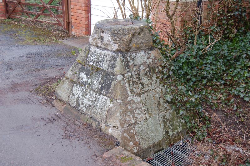
AB KETTLEBY WELL LANE
(East Side)
SK 72 22 Well-head
21/241
1.1.68 II
Well-head. Probably medieval. Limestone. Octagonal top on pyramidal
plinth. Ironstone spout below S side of plinth. Probably made up of some
elements of village cross.
Listing NGR: SK7248923004
External links are from the relevant listing authority and, where applicable, Wikidata. Wikidata IDs may be related buildings as well as this specific building. If you want to add or update a link, you will need to do so by editing the Wikidata entry.


Other nearby listed buildings