Approximate Location Map
Large Map »
Latitude: 52.443 / 52°26'34"N
Longitude: -1.9695 / 1°58'10"W
OS Eastings: 402167
OS Northings: 282787
OS Grid: SP021827
Mapcode National: GBR 5HQ.Z3
Mapcode Global: VH9Z1.TV4J
Plus Code: 9C4WC2VJ+65
Entry Name: Remains of Weoley Castle
Listing Date: 25 April 1952
Grade: II
Source: Historic England
Source ID: 1075769
English Heritage Legacy ID: 216731
ID on this website: 101075769
Location: California, Birmingham, West Midlands, B29
County: Birmingham
Parish: Non Civil Parish
Built-Up Area: Birmingham
Traditional County: Worcestershire
Lieutenancy Area (Ceremonial County): West Midlands
Church of England Parish: Weoley Castle
Church of England Diocese: Birmingham
ALWOLD ROAD
1.
5104
Weoley Castle B29
Remains of Weoley Castle
(formerly listed under
Selly Oak)
SP 08 SW 11/1 25.4.52
II
2.
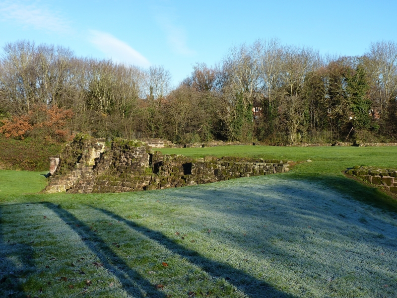
Footings and foundations of a fortified manor house. Sandstone with 6 towers
and a deep moat. These works date from 1264 when Roger de Somery was licensed
to crenellate his manor house. A survey of 1422 gives a detailed plan. Fragments
of early C13 wooden buildings have been discovered, indicating early use of
both horizontal and vertical weatherboarding.
Listing NGR: SP0216782787
External links are from the relevant listing authority and, where applicable, Wikidata. Wikidata IDs may be related buildings as well as this specific building. If you want to add or update a link, you will need to do so by editing the Wikidata entry.


Other nearby listed buildings
