Approximate Location Map
Large Map »
Latitude: 53.5398 / 53°32'23"N
Longitude: -2.9602 / 2°57'36"W
OS Eastings: 336464
OS Northings: 405220
OS Grid: SD364052
Mapcode National: GBR 7WRH.XT
Mapcode Global: WH86N.H9M5
Plus Code: 9C5VG2QQ+WW
Entry Name: Cross Approximately 10 Metres North of Church of Our Lady
Listing Date: 11 October 1968
Grade: II
Source: Historic England
Source ID: 1075838
English Heritage Legacy ID: 216492
ID on this website: 101075838
Location: Our Lady's Roman Catholic Church, Sefton, Merseyside, L31
County: Sefton
Civil Parish: Lydiate
Built-Up Area: Maghull
Traditional County: Lancashire
Lieutenancy Area (Ceremonial County): Merseyside
Church of England Parish: Lydiate and Downholland, Saint Thomas
Church of England Diocese: Liverpool
Tagged with: Building
SD 30 NE
4/93
LYDIATE,
SOUTHPORT ROAD (east side),
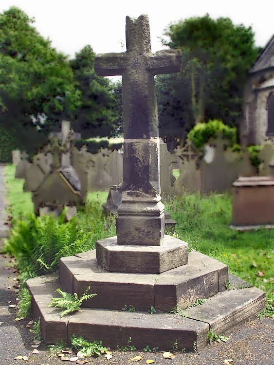
Cross approx. 10m. north of church of Our Lady
11.10.68
G.V. II
Cross. Upper part medieval, lower part a C19 restoration. Retrieved from nearby field in 1870s. Stone. 3 hexagonal steps, moulded plinth and chamfered cross.
Listing NGR: SD3646405220
External links are from the relevant listing authority and, where applicable, Wikidata. Wikidata IDs may be related buildings as well as this specific building. If you want to add or update a link, you will need to do so by editing the Wikidata entry.


Other nearby listed buildings
