Latitude: 53.5364 / 53°32'11"N
Longitude: -2.96 / 2°57'36"W
OS Eastings: 336470
OS Northings: 404845
OS Grid: SD364048
Mapcode National: GBR 7WRK.Y0
Mapcode Global: WH86N.HCPS
Plus Code: 9C5VG2PQ+HX
Entry Name: The Scotch Piper Public House
Listing Date: 11 October 1968
Grade: II*
Source: Historic England
Source ID: 1343315
English Heritage Legacy ID: 216497
Also known as: Scotch Piper Inn, Lydiate
ID on this website: 101343315
Location: Lydiate, Sefton, Merseyside, L31
County: Sefton
Civil Parish: Lydiate
Built-Up Area: Maghull
Traditional County: Lancashire
Lieutenancy Area (Ceremonial County): Merseyside
Church of England Parish: Lydiate and Downholland, Saint Thomas
Church of England Diocese: Liverpool
Tagged with: Pub Thatched pub
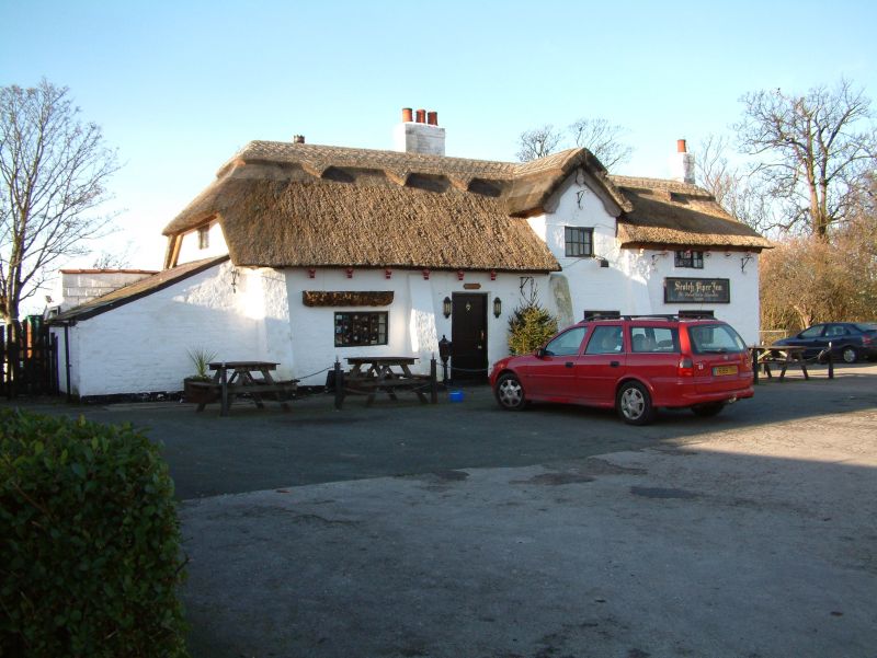
LYDIATE SOUTHPORT ROAD SD 30 SE (west side) 7/98 The Scotch Piper 11.10.68 Public House G.V. II* Public House. Said to date from 1320, probably C 16. Cruck-framed, with lime-washed brick walls and thatched roof. 2 storeys and 3 irregular bays. 4 battered buttresses to southern end. Windows have 2-and 3-light horizontally sliding sashes with glazing bars. Entrance between 1st and 2nd bays has 4-panel door. 2nd bay has gabled dormer; end bay has higher eaves over attic window. 2 brick stacks. Later additions to left return and rear. Interior has at least 2 cruck trusses. Ground floor has some chamfered beams, one is elaborately moulded. Wattle chimney hood at first floor.
Listing NGR: SD3647004845
External links are from the relevant listing authority and, where applicable, Wikidata. Wikidata IDs may be related buildings as well as this specific building. If you want to add or update a link, you will need to do so by editing the Wikidata entry.


Other nearby listed buildings