Approximate Location Map
Large Map »
Latitude: 52.4553 / 52°27'19"N
Longitude: -2.1476 / 2°8'51"W
OS Eastings: 390063
OS Northings: 284159
OS Grid: SO900841
Mapcode National: GBR 1C4.3TH
Mapcode Global: VH91H.QKH4
Plus Code: 9C4VFV42+4W
Entry Name: 65, Market Street
Listing Date: 10 September 1971
Grade: II
Source: Historic England
Source ID: 1076043
English Heritage Legacy ID: 217866
ID on this website: 101076043
Location: Stourbridge, Dudley, West Midlands, DY8
County: Dudley
Electoral Ward/Division: Wollaston and Stourbridge Town
Parish: Non Civil Parish
Built-Up Area: Stourbridge
Traditional County: Worcestershire
Lieutenancy Area (Ceremonial County): West Midlands
Church of England Parish: Stourbridge St Thomas
Church of England Diocese: Worcester
Tagged with: Building
This list entry was subject to a Minor Amendment on 30/09/2020
SO 9084
1/48
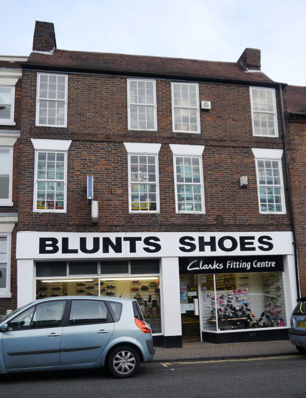
MARKET STREET (east side)
No 65
GV
II
Late C18. Brick, machine tile roof gables abutted on both sides. Three storeys, four windows. Eighteen-pane sashes. Modern shop windows.
Nos 63 to 75 (odd) form a group.
Listing NGR: SO9006884167
External links are from the relevant listing authority and, where applicable, Wikidata. Wikidata IDs may be related buildings as well as this specific building. If you want to add or update a link, you will need to do so by editing the Wikidata entry.


Other nearby listed buildings
