Approximate Location Map
Large Map »
Latitude: 52.4547 / 52°27'17"N
Longitude: -2.1467 / 2°8'48"W
OS Eastings: 390126
OS Northings: 284098
OS Grid: SO901840
Mapcode National: GBR 1C4.42N
Mapcode Global: VH91H.QKZK
Plus Code: 9C4VFV33+V8
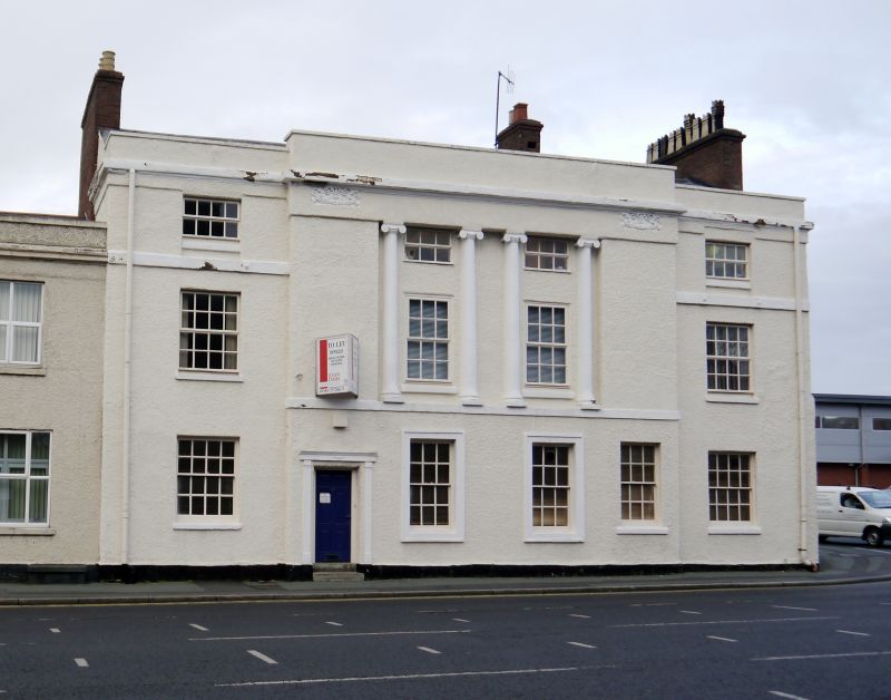
Entry Name: 40, New Road
Listing Date: 8 November 1949
Grade: II
Source: Historic England
Source ID: 1107195
English Heritage Legacy ID: 217868
ID on this website: 101107195
Location: Stourbridge, Dudley, West Midlands, DY8
County: Dudley
Electoral Ward/Division: Wollaston and Stourbridge Town
Parish: Non Civil Parish
Built-Up Area: Stourbridge
Traditional County: Worcestershire
Lieutenancy Area (Ceremonial County): West Midlands
Church of England Parish: Stourbridge St Thomas
Church of England Diocese: Worcester
Tagged with: Building
SO 9084
1/25
NEW ROAD
No 40
8.11.1949
II
Early C19. Roughcast; three storeys; five windows of three bays, the central having four Ionic fluted columns inset between the upper storeys. Recessed segmental-headed door left hand bends. Frieze with moulded panels and wreathed paterae. Moulded cornice; parapet.
Listing NGR: SO9012684098
External links are from the relevant listing authority and, where applicable, Wikidata. Wikidata IDs may be related buildings as well as this specific building. If you want to add or update a link, you will need to do so by editing the Wikidata entry.


Other nearby listed buildings
