Approximate Location Map
Large Map »
Latitude: 52.4371 / 52°26'13"N
Longitude: -2.1311 / 2°7'51"W
OS Eastings: 391184
OS Northings: 282129
OS Grid: SO911821
Mapcode National: GBR 1CC.225
Mapcode Global: VH91Q.00QK
Plus Code: 9C4VCVP9+RH
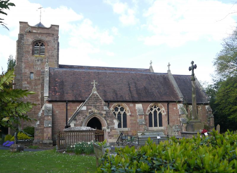
Entry Name: Parish Church of St Peter
Listing Date: 8 November 1949
Grade: II
Source: Historic England
Source ID: 1076044
English Heritage Legacy ID: 217869
ID on this website: 101076044
Location: St Peter's Church, Pedmore, Dudley, West Midlands, DY9
County: Dudley
Electoral Ward/Division: Pedmore and Stourbridge East
Parish: Non Civil Parish
Built-Up Area: Stourbridge
Traditional County: Worcestershire
Lieutenancy Area (Ceremonial County): West Midlands
Church of England Parish: Pedmore
Church of England Diocese: Worcester
Tagged with: Church building
1.
1682 PEDMORE
Parish Church
of St Peter
SO 98 SW 3/37 8.11.49.
C
2.
Mainly C19, retaining some Norman work, a good late C11 - Early C12
tympanum and a C14 font.
Listing NGR: SO9118482129
External links are from the relevant listing authority and, where applicable, Wikidata. Wikidata IDs may be related buildings as well as this specific building. If you want to add or update a link, you will need to do so by editing the Wikidata entry.


Other nearby listed buildings
