Approximate Location Map
Large Map »
Latitude: 52.3356 / 52°20'8"N
Longitude: -1.1747 / 1°10'28"W
OS Eastings: 456333
OS Northings: 271154
OS Grid: SP563711
Mapcode National: GBR 8R2.HV4
Mapcode Global: VHCTZ.LKCD
Plus Code: 9C4W8RPG+64
Entry Name: Wall Approximately 12 Metres North East of Church of St Faith
Listing Date: 11 March 1987
Grade: II
Source: Historic England
Source ID: 1076438
English Heritage Legacy ID: 361055
ID on this website: 101076438
Location: Emery Row, West Northamptonshire, CV23
County: West Northamptonshire
Civil Parish: Kilsby
Built-Up Area: Kilsby
Traditional County: Northamptonshire
Lieutenancy Area (Ceremonial County): Northamptonshire
Church of England Parish: Kilsby St Faith
Church of England Diocese: Peterborough
Tagged with: Wall
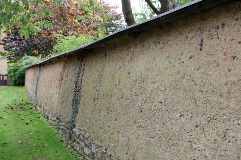
KILSBY CHURCH WALK
SP5671
14/162 Wall approx. 12m. NE of Church
of St. Faith
GV II
Wall. C18/ early Cl9. Cob construction, corrugated iron coping. Included for
group value.
Listing NGR: SP5633371154
External links are from the relevant listing authority and, where applicable, Wikidata. Wikidata IDs may be related buildings as well as this specific building. If you want to add or update a link, you will need to do so by editing the Wikidata entry.


Other nearby listed buildings
