Approximate Location Map
Large Map »
Latitude: 51.7595 / 51°45'34"N
Longitude: -0.5612 / 0°33'40"W
OS Eastings: 499401
OS Northings: 207731
OS Grid: SP994077
Mapcode National: GBR F55.NXW
Mapcode Global: VHFS4.715J
Plus Code: 9C3XQC5Q+QG
Entry Name: 120, High Street
Listing Date: 9 May 1973
Grade: II
Source: Historic England
Source ID: 1076678
English Heritage Legacy ID: 355445
ID on this website: 101076678
Location: Dacorum, Hertfordshire, HP4
County: Hertfordshire
District: Dacorum
Civil Parish: Berkhamsted
Built-Up Area: Berkhamsted
Traditional County: Hertfordshire
Lieutenancy Area (Ceremonial County): Hertfordshire
Church of England Parish: Great Berkhamsted
Church of England Diocese: St.Albans
Tagged with: Building
1.
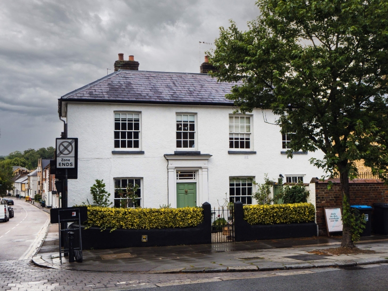
839 HIGH STREET
(North Side)
No 120
SP 9907 NW 1/7
II
2.
Late C18 or early C19. Roughcast, hipped Welsh slate roof. 4 sash windows
with glazing bars, 2 storeys. 6 fielded panel central door with oblong
fanlight with glazing bars; surround of Doric pilasters, entablature with
reeded frieze with paterae and sheafs, dentil cornice.
Listing NGR: SP9940107731
External links are from the relevant listing authority and, where applicable, Wikidata. Wikidata IDs may be related buildings as well as this specific building. If you want to add or update a link, you will need to do so by editing the Wikidata entry.


Other nearby listed buildings
