Approximate Location Map
Large Map »
Latitude: 52.4152 / 52°24'54"N
Longitude: -1.7777 / 1°46'39"W
OS Eastings: 415218
OS Northings: 279708
OS Grid: SP152797
Mapcode National: GBR 4J0.FF1
Mapcode Global: VH9ZC.4KKD
Plus Code: 9C4WC68C+3W
Entry Name: 685 and 685A, Warwick Road
Listing Date: 22 July 1976
Grade: II
Source: Historic England
Source ID: 1076697
English Heritage Legacy ID: 218308
ID on this website: 101076697
Location: Solihull, West Midlands, B91
County: Solihull
Electoral Ward/Division: St Alphege
Parish: Non Civil Parish
Built-Up Area: Solihull
Traditional County: Warwickshire
Lieutenancy Area (Ceremonial County): West Midlands
Church of England Parish: Solihull
Church of England Diocese: Birmingham
Tagged with: Building
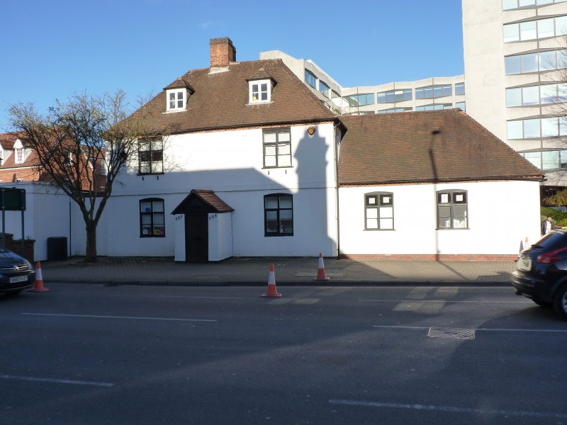
SOLIHULL WARWICK ROAD
1.
5108
(North-East Side)
Nos 685 and 685A
SP 1579 1/472
II GV
2.
C18. Whitewashed brick, hipped old tiled roof. 2 hipped dormers. 2 storeys and
attics. 2 flush casements. Projecting C19 shop on right.
Nos 681 to 685 (odd) and No 68A form a group.
Listing NGR: SP1521879708
External links are from the relevant listing authority and, where applicable, Wikidata. Wikidata IDs may be related buildings as well as this specific building. If you want to add or update a link, you will need to do so by editing the Wikidata entry.


Other nearby listed buildings
