Latitude: 52.3912 / 52°23'28"N
Longitude: -1.7382 / 1°44'17"W
OS Eastings: 417913
OS Northings: 277046
OS Grid: SP179770
Mapcode National: GBR 4JF.5CB
Mapcode Global: VH9ZK.T5G8
Plus Code: 9C4W97R6+FP
Entry Name: 1619, Warwick Road
Listing Date: 22 July 1976
Grade: II
Source: Historic England
Source ID: 1076701
English Heritage Legacy ID: 218318
ID on this website: 101076701
Location: Knowle, Solihull, West Midlands, B93
County: Solihull
Electoral Ward/Division: Knowle
Parish: Non Civil Parish
Built-Up Area: Solihull
Traditional County: Warwickshire
Lieutenancy Area (Ceremonial County): West Midlands
Church of England Parish: Knowle
Church of England Diocese: Birmingham
Tagged with: Building
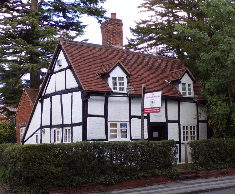
SOLIHULL KNOWLE
1.
5108
WARWICK ROAD
(North-East Side)
No 1619
SP 1777 21/39
II
2.
C17. Timber frame, colour washed brick nogging, old tiled roof with 2 gabled dormers.
1 storey and attics, flush casement windows with glazing bars. Lean-to addition
at back.
Listing NGR: SP1791377046
External links are from the relevant listing authority and, where applicable, Wikidata. Wikidata IDs may be related buildings as well as this specific building. If you want to add or update a link, you will need to do so by editing the Wikidata entry.


Other nearby listed buildings