Approximate Location Map
Large Map »
Latitude: 52.4379 / 52°26'16"N
Longitude: -1.6496 / 1°38'58"W
OS Eastings: 423915
OS Northings: 282276
OS Grid: SP239822
Mapcode National: GBR 5K9.3RS
Mapcode Global: VHBWP.CZ8G
Plus Code: 9C4WC9Q2+55
Entry Name: The Village Cross
Listing Date: 8 September 1961
Grade: II
Source: Historic England
Source ID: 1076746
English Heritage Legacy ID: 218231
ID on this website: 101076746
Location: The Green, Meriden, Solihull, West Midlands, CV7
County: Solihull
Civil Parish: Meriden
Built-Up Area: Meriden
Traditional County: Warwickshire
Lieutenancy Area (Ceremonial County): West Midlands
Church of England Parish: Meriden St Laurence
Church of England Diocese: Coventry
Tagged with: Building
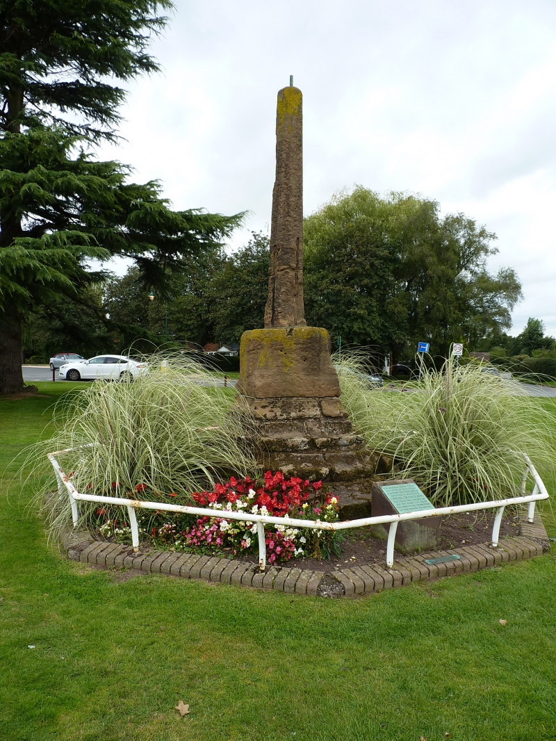
THE GREEN
1.
5108 MERIDEN
The Village Cross
SP 2382 23/383 8.9.61.
II
2.
Medieval. Stepped octagonal plinth has 3 much worn stone steps supporting square
plan base stone, broached to octagonal top under tapering octagonal shaft. Popularly
said to mark the centre of England.
Listing NGR: SP2391682271
External links are from the relevant listing authority and, where applicable, Wikidata. Wikidata IDs may be related buildings as well as this specific building. If you want to add or update a link, you will need to do so by editing the Wikidata entry.


Other nearby listed buildings
