Latitude: 52.5214 / 52°31'16"N
Longitude: -1.9726 / 1°58'21"W
OS Eastings: 401953
OS Northings: 291500
OS Grid: SP019915
Mapcode National: GBR 2HT.91
Mapcode Global: VH9YN.RWHH
Plus Code: 9C4WG2CG+HW
Entry Name: Farm Buildings at Sandwell Park Farm, Enclosing Farmyard, and Cart Shed and Building Attached to South West Side, off Lodge Hill Road
Listing Date: 9 January 1981
Grade: II
Source: Historic England
Source ID: 1077100
English Heritage Legacy ID: 219387
ID on this website: 101077100
Location: Mayer's Green, Sandwell, West Midlands, B71
County: Sandwell
Electoral Ward/Division: West Bromwich Central
Parish: Non Civil Parish
Built-Up Area: West Bromwich
Traditional County: Staffordshire
Lieutenancy Area (Ceremonial County): West Midlands
Church of England Parish: West Bromwich All Saints
Church of England Diocese: Lichfield
Tagged with: Agricultural structure
SANDWELL MB WEST BROMWICH, SANDWELL VALLEY SP 09 SW 5/166 Farm buildings at Sandwell Park Farm, enclosing farm- 9.1.81 yard, and cart shed and building attached to south- west side, off Lodge Hill Road
II
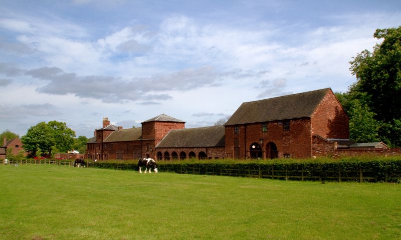
Farm buildings, now visitors' centre. Probably c1800. Brick with tile roofs. Arranged around a square farmyard, with buildings on three sides and wall enclosing south side. Two storeys, with three-storey corner pavilions under pyramid roofs. North-east tower contains dovecote. On east side of courtyard the buildings have doors and windows with segmental heads. On the west side is an open shed with a seven-bay arcade of elliptical arches. On the north side is a barn. This has two cart entrances with elliptical arches, with a third similar arch to the east containing smaller doorways. Adjoining to the west is a single-storey cartshed, now an exhibition wing, with six-bay arcade now glazed. Adjoining it further west is a two-storey building with two arched cart entrances. These planned farm buildings were built as the home farm on the Earl of Dartmouth's Sandwell Hall estate. Sandwell Hall was demolished in 1928.
Listing NGR: SP0195391500
External links are from the relevant listing authority and, where applicable, Wikidata. Wikidata IDs may be related buildings as well as this specific building. If you want to add or update a link, you will need to do so by editing the Wikidata entry.


Other nearby listed buildings