Latitude: 51.603 / 51°36'10"N
Longitude: -0.0744 / 0°4'27"W
OS Eastings: 533452
OS Northings: 191106
OS Grid: TQ334911
Mapcode National: GBR H8.PWW
Mapcode Global: VHGQF.NZJ1
Plus Code: 9C3XJW3G+56
Entry Name: 39-51, Beaufoy Road N17
Listing Date: 10 May 1974
Grade: II
Source: Historic England
Source ID: 1079254
English Heritage Legacy ID: 201310
ID on this website: 101079254
Location: Haringey, London, N17
County: London
District: Haringey
Electoral Ward/Division: Northumberland Park
Parish: Non Civil Parish
Built-Up Area: Haringey
Traditional County: Middlesex
Lieutenancy Area (Ceremonial County): Greater London
Church of England Parish: All Hallows Tottenham
Church of England Diocese: London
Tagged with: Building
1. 4415 BEAUFOY ROAD N17 (West Side) Tottenham ----------------- Nos 39 to 51 (odd) TQ 3391 7/9
II GV
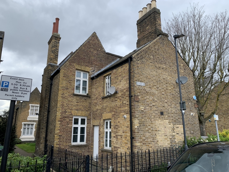
2. Range of houses of Gothic character around three sides of small square. Third quarter of C19. Each two storeys, one window. Tall proportions with front gables to high pitched slated roofs. Stock brick with stone dressing, lst floor two-light and ground floor three-light mullioned and transomed casements, with segmental relieving arches over. Altered doors with fanlights under four-centred gauged brick arches. Similar arches to back yards flank Nos 43 and 47. Illegible coat of arms and motto on gable end of No 45. These are the former Alderman Staines Almshouses, successors to the old Almshouses in Jacob's Passage in the parish of St Giles without, Cripplegate, which were sold in 1864 to make land for the Metropolitan Railway, and rebuilt in Tottenham in 1868 from th+e proceeds. Included partly for historical interest. Nos 39 to 51 (odd) form a group.
Listing NGR: TQ3345291106
External links are from the relevant listing authority and, where applicable, Wikidata. Wikidata IDs may be related buildings as well as this specific building. If you want to add or update a link, you will need to do so by editing the Wikidata entry.


Other nearby listed buildings