Latitude: 51.4887 / 51°29'19"N
Longitude: -0.1118 / 0°6'42"W
OS Eastings: 531195
OS Northings: 178334
OS Grid: TQ311783
Mapcode National: GBR MN.2H
Mapcode Global: VHGR0.0VS3
Plus Code: 9C3XFVQQ+F7
Entry Name: Church of St Anselm
Listing Date: 19 October 1951
Grade: II
Source: Historic England
Source ID: 1080402
English Heritage Legacy ID: 204371
Also known as: St Anselm's Church, Kennington
ID on this website: 101080402
Location: Vauxhall, Lambeth, London, SE11
County: London
District: Lambeth
Electoral Ward/Division: Prince's
Parish: Non Civil Parish
Built-Up Area: Lambeth
Traditional County: Surrey
Lieutenancy Area (Ceremonial County): Greater London
Church of England Parish: North Lambeth
Church of England Diocese: Southwark
Tagged with: Church building
KENNINGTON ROAD SE11 1. (west side) 5023 Church of St Anselm TQ 3178 5/556 19.10.51
II
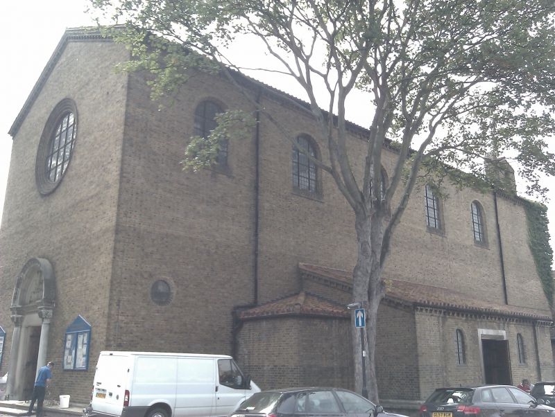
2. 1932-33 by Adshead and Ramsey, built on foundations of earlier church whose building was interrupted by World War I. Simple Early christian basilica of stock brick with corbelled eaves cornice of shaped bricks and pantiled roof. Low, pent aisles, not full length. Chamfered, round-arched window openings. Church is disoriented with large east protal having carving of St Anselm with lion and lamb in tympanum. Tall, barn-like interior has timber king post roof trusses, gallery over entrance, baldacchino over altar. Arcade capitals of cushion shape and carved with plants and animals by A H Gerrard. Carved font by Derrick Frith.
Listing NGR: TQ3119578334
External links are from the relevant listing authority and, where applicable, Wikidata. Wikidata IDs may be related buildings as well as this specific building. If you want to add or update a link, you will need to do so by editing the Wikidata entry.


Other nearby listed buildings