Latitude: 52.2694 / 52°16'9"N
Longitude: -2.2296 / 2°13'46"W
OS Eastings: 384425
OS Northings: 263497
OS Grid: SO844634
Mapcode National: GBR 1F5.M3X
Mapcode Global: VH92F.97M3
Plus Code: 9C4V7Q9C+Q4
Entry Name: Watkins Memorial About 15 Yards North-East of the Sandys Mausoleum
Listing Date: 21 March 1985
Grade: II
Source: Historic England
Source ID: 1081101
English Heritage Legacy ID: 148083
ID on this website: 101081101
Location: St Andrew's Church, Ombersley, Wychavon, Worcestershire, WR9
County: Worcestershire
District: Wychavon
Civil Parish: Ombersley
Built-Up Area: Ombersley
Traditional County: Worcestershire
Lieutenancy Area (Ceremonial County): Worcestershire
Church of England Parish: Ombersley
Church of England Diocese: Worcester
Tagged with: Building
SO 8463
9/188
OMBERSLEY CP
WORCESTER ROAD (west side)
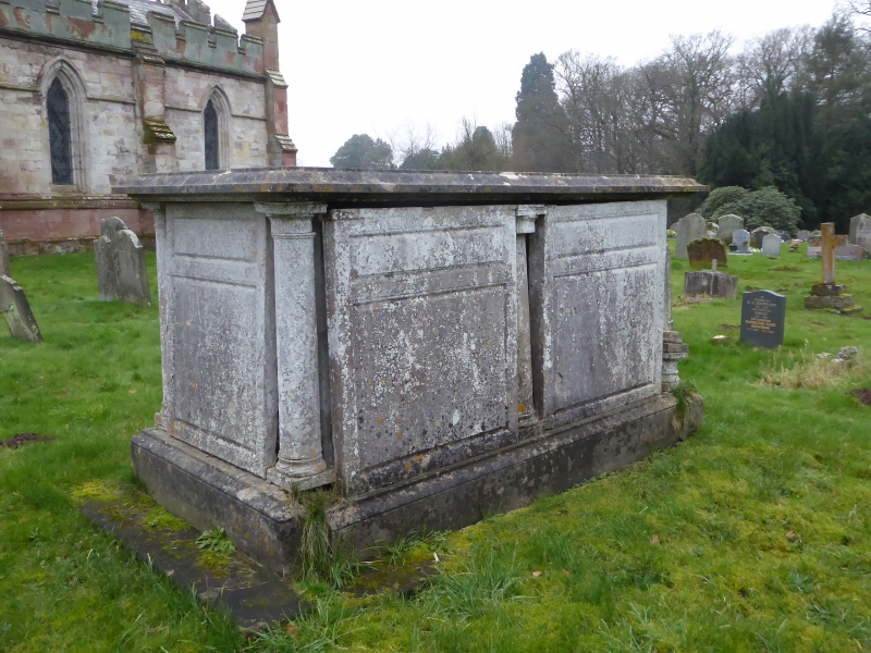
Watkins memorial about 15 yards north-east of the Sandys Mausoleum
GV
II
Chest tomb. Early C19. Sandstone ashlar. Moulded base and flat capping;
rebates at corners and centre of sides have Doric columns with fluted
capitals. Moulded inscription panels commemorate Mary Watkins, died 1816,
and John Watkins, died 1833.
Listing NGR: SO8442863503
External links are from the relevant listing authority and, where applicable, Wikidata. Wikidata IDs may be related buildings as well as this specific building. If you want to add or update a link, you will need to do so by editing the Wikidata entry.


Other nearby listed buildings