Latitude: 52.3019 / 52°18'6"N
Longitude: -2.7722 / 2°46'19"W
OS Eastings: 347440
OS Northings: 267365
OS Grid: SO474673
Mapcode National: GBR BH.X462
Mapcode Global: VH770.WDTQ
Plus Code: 9C4V862H+Q4
Entry Name: Ashley Moor Farmhouse
Listing Date: 11 June 1959
Grade: II
Source: Historic England
Source ID: 1081811
English Heritage Legacy ID: 150107
ID on this website: 101081811
Location: Ashley Moor, County of Herefordshire, SY8
County: County of Herefordshire
Civil Parish: Orleton
Traditional County: Herefordshire
Lieutenancy Area (Ceremonial County): Herefordshire
Church of England Parish: Orleton
Church of England Diocese: Hereford
Tagged with: Farmhouse
SO 46 NE ORLETON CP ASHLEY MOOR
3/85 Ashley Moor Farmhouse
11.6.59
GV II
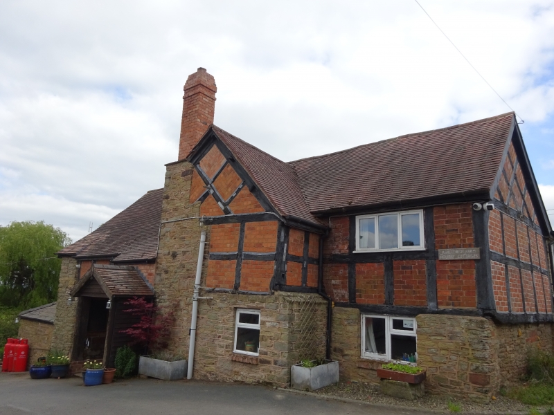
Farmhouse. Early C17, extended late C17 and late C18 with some mid-C20 alterations. Timber-frame with brick infill on rubble base, extended in coursed rubble, with a machine tile roof. L-plan with C17 range to north- east, C18 range of rubble to south-east. The main stack on north-west wall is of rubble with a brick shaft, also i lateral stack on south-west wall of southern range. Road (south-west) front gabled to left slightly jettied over rubble ground floor. A casement in the gable lights the upper floor, ground floor blind, range to right has a 2-light casement over the entrance which has a hipped slate roof and a panelled door. Framing: four square panels high to side walls, gable end has chamfered bressummer to jetty and diagonal framing in the truss above. Main stack is partially within a short gabled wing with diagonally framed truss. Interior has some ovolo moulded ceiling beams. (RCHM, 3, p 159, no 32).
Listing NGR: SO4744067365
External links are from the relevant listing authority and, where applicable, Wikidata. Wikidata IDs may be related buildings as well as this specific building. If you want to add or update a link, you will need to do so by editing the Wikidata entry.


Other nearby listed buildings