Latitude: 52.3119 / 52°18'42"N
Longitude: -2.5957 / 2°35'44"W
OS Eastings: 359485
OS Northings: 268368
OS Grid: SO594683
Mapcode National: GBR BQ.WKN6
Mapcode Global: VH84K.Y5M0
Plus Code: 9C4V8C63+QP
Entry Name: 12-14, Church Street
Listing Date: 16 October 1974
Last Amended: 24 October 1988
Grade: II
Source: Historic England
Source ID: 1082424
English Heritage Legacy ID: 150769
ID on this website: 101082424
Location: Tenbury Wells, Malvern Hills, Worcestershire, WR15
County: Worcestershire
District: Malvern Hills
Civil Parish: Tenbury
Built-Up Area: Tenbury Wells
Traditional County: Worcestershire
Lieutenancy Area (Ceremonial County): Worcestershire
Church of England Parish: Tenbury Wells
Church of England Diocese: Hereford
Tagged with: Building
TENBURY CP CHURCH STREET (east side) SO 5868 - 5968 8/78 Nos 12 - 14 (consec) [formerly listed as 16.10.74 Nos 12 - 15 (consec)]
GV II
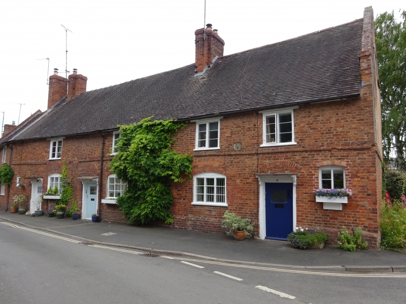
Row of houses. Early C18 with mid-C19 and mid-C20 alterations: Handmade brick, partly rendered and plain tiled roof, gable-end parapets with kneelers and brick ridge stack at north end and to right of centre. Two storeys and attic with chamfered plinth and two-course band at first floor level. Four irregular bays. Three 3-light C19 casements with cambered heads (one is inserted within a blocked opening with a cambered head), one small rectangular window and one 2-light window with a cambered head on the ground floor and four 2-light windows on the first floor. Three doorways with flat canopies on shaped brackets and partly glazed C20 doors. The doorway to No 12 has a moulded architrave and a semi-circular relieving arch. Attic light at south end.
Listing NGR: SO5948568368
External links are from the relevant listing authority and, where applicable, Wikidata. Wikidata IDs may be related buildings as well as this specific building. If you want to add or update a link, you will need to do so by editing the Wikidata entry.


Other nearby listed buildings