Latitude: 52.1168 / 52°7'0"N
Longitude: -3.0296 / 3°1'46"W
OS Eastings: 329594
OS Northings: 247001
OS Grid: SO295470
Mapcode National: GBR F5.8T93
Mapcode Global: VH77V.F2Q2
Plus Code: 9C4R4X8C+P4
Entry Name: Barn and Adjoining Outbuilding About 25 Yards North-West of Winforton Court
Listing Date: 31 October 1988
Grade: II
Source: Historic England
Source ID: 1082471
English Heritage Legacy ID: 150687
ID on this website: 101082471
Location: Winforton, County of Herefordshire, HR3
County: County of Herefordshire
Civil Parish: Willersley and Winforton
Traditional County: Herefordshire
Lieutenancy Area (Ceremonial County): Herefordshire
Church of England Parish: Winforton
Church of England Diocese: Hereford
Tagged with: Barn
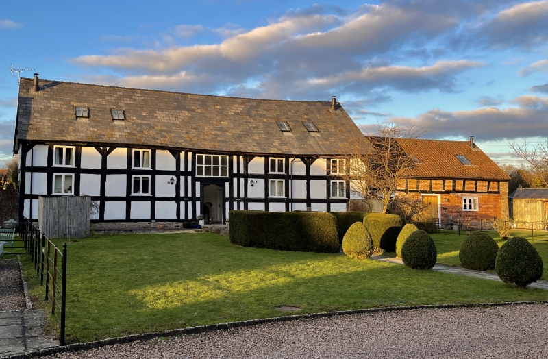
WINFORTON CP WINFORTON SO 24 NE 5/132 Barn and adjoining outbuilding about 25 yards north-west of Winforton Court GV II Barn and adjoining outbuilding, now showroom. C17, converted late C20. Timber- framed with rendered infill on rubble base with slate roof. Five framed bays aligned east/west. Central wagon bay with opposed cart entries now blocked. Framing: three rows of square panels from sill to wall-plate, very short upper corner braces and collar and tie-beam end trusses with three struts beneath collar and V-strut above. Main south elevation: outer bays each have a C20 casement of two leaded lights inserted in the central panel. Central bay is infilled with three rows of close-set vertical studding and has a 4-light C20 mullioned and transomed window with leaded glass, and beneath it a C20 studded door with strap hinges and a shaped head. Also door with plank weathering at west end. Interior not inspected. Outbuilding adjoins east gable end. Part rubble and brick, part timber-framed with brick infill and machine-tiled roof. Three bays, two levels. Framing: one row of square panels at eaves level in side elevations. Main south elevation has two ground floor 3-light casements and a C20 stable door. (RCHM, III, p 213, item 3).
Listing NGR: SO2959447001
External links are from the relevant listing authority and, where applicable, Wikidata. Wikidata IDs may be related buildings as well as this specific building. If you want to add or update a link, you will need to do so by editing the Wikidata entry.


Other nearby listed buildings