Latitude: 53.7457 / 53°44'44"N
Longitude: -0.8653 / 0°51'55"W
OS Eastings: 474928
OS Northings: 428295
OS Grid: SE749282
Mapcode National: GBR QTD4.G0
Mapcode Global: WHFDC.P34V
Plus Code: 9C5XP4WM+7V
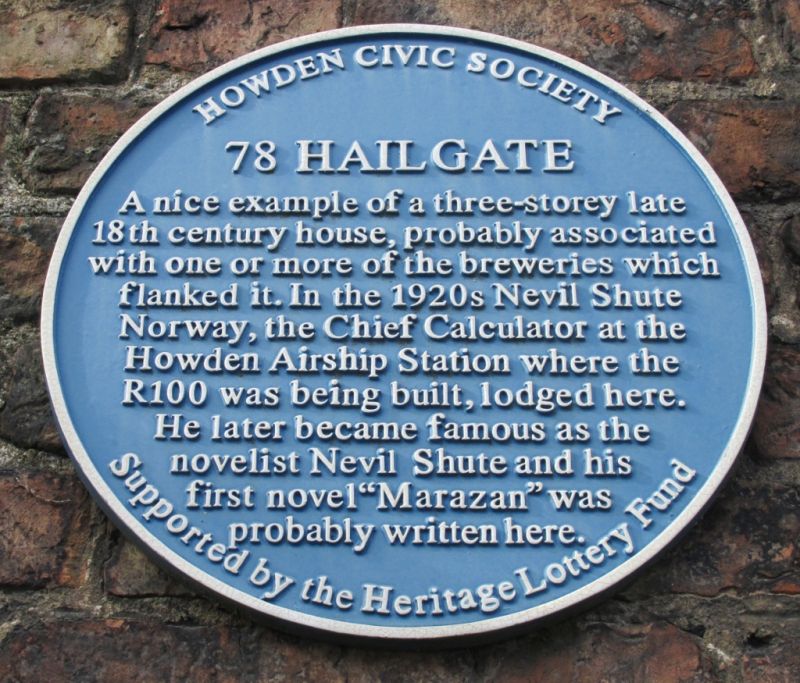
Entry Name: 78, Hailgate
Listing Date: 16 December 1966
Grade: II
Source: Historic England
Source ID: 1083194
English Heritage Legacy ID: 165333
ID on this website: 101083194
Location: Howden, East Riding of Yorkshire, DN14
County: East Riding of Yorkshire
Civil Parish: Howden
Built-Up Area: Howden
Traditional County: Yorkshire
Lieutenancy Area (Ceremonial County): East Riding of Yorkshire
Church of England Parish: Howden with Barmby on the Marsh
Church of England Diocese: York
Tagged with: Building
HOWDEN HAILGATE
SE 7428
(west side)
12/105 No 78
16.12.66
GV II
House, now 4 flats. Late C18 - early C19. Brown brick with red brick
quoins and window jambs and rubbed brick arches, French tile roof. Central-
hallway entry. 3 storeys, 3 bays. Half-glazed door beneath radial fanlight
in doorcase with panelled reveals and fluted pilasters carrying dentilled
open pediment with urn and festoons to tympanum. 4-pane sashes with stone
sills beneath rubbed brick arches throughout, those to second floor
unequally hung. Cyma recta timber eaves band. Gable coping, shaped
kneelers, end stacks. Interior: open-string staircase with 2 turned
balusters per tread. Arch on landing with imposts. Neave D, Howden
Explored, 1979.
Listing NGR: SE7492828295
External links are from the relevant listing authority and, where applicable, Wikidata. Wikidata IDs may be related buildings as well as this specific building. If you want to add or update a link, you will need to do so by editing the Wikidata entry.


Other nearby listed buildings