Latitude: 53.4898 / 53°29'23"N
Longitude: -0.8482 / 0°50'53"W
OS Eastings: 476517
OS Northings: 399846
OS Grid: SK765998
Mapcode National: GBR QXJ2.5R
Mapcode Global: WHFFJ.YK80
Plus Code: 9C5XF5Q2+WP
Entry Name: Cross Base Approximately 25 Metres East of Church of St Nicholas
Listing Date: 10 September 1987
Grade: II
Source: Historic England
Source ID: 1083252
English Heritage Legacy ID: 165165
ID on this website: 101083252
Location: Haxey, North Lincolnshire, DN9
County: North Lincolnshire
Civil Parish: Haxey
Built-Up Area: Haxey
Traditional County: Lincolnshire
Lieutenancy Area (Ceremonial County): Lincolnshire
Church of England Parish: Haxey St Nicholas
Church of England Diocese: Lincoln
SK 7699-7799 HAXEY CHURCH STREET (south side)
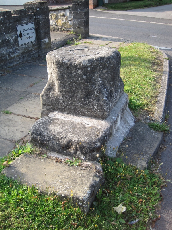
22/104 Cross base approximately 25 metres east of Church of St Nicholas
GV II
Cross base. Medieval, reset in C19-C20. Limestone ashlar; brick patching to base. Drum pedestal with square-section foot and broach stops to octagonal upper section. Stump of former cross shaft in leaded socket broken flush with top. Limestone and brick base with single worn steps to south, east and west sides. The cross base is also known locally as the "Lady Mowbray" or "Hood Stone", from its association with the traditional "Haxey Hood" game, held on January 6th, where it is used as the site of the Fool's Speech and ceremony of "Smoking the Fool". E H Rudkin, Lincolnshire Folklore, 1973, pp xiv-xvi, pp 90-97.
Listing NGR: SK7652099845


Other nearby listed buildings