Approximate Location Map
Large Map »
Latitude: 51.1327 / 51°7'57"N
Longitude: 0.2608 / 0°15'38"E
OS Eastings: 558279
OS Northings: 139480
OS Grid: TQ582394
Mapcode National: GBR MPS.SWW
Mapcode Global: VHHQD.GSRJ
Plus Code: 9F3247M6+38
Entry Name: 16 and 18, Church Road
Listing Date: 7 June 1974
Grade: II
Source: Historic England
Source ID: 1083760
English Heritage Legacy ID: 167951
ID on this website: 101083760
Location: Royal Tunbridge Wells, Tunbridge Wells, Kent, TN1
County: Kent
District: Tunbridge Wells
Electoral Ward/Division: Culverden
Parish: Non Civil Parish
Built-Up Area: Royal Tunbridge Wells
Traditional County: Kent
Lieutenancy Area (Ceremonial County): Kent
Church of England Parish: Tunbridge Wells Holy Trinity with Christ Church
Church of England Diocese: Rochester
Tagged with: Building
CHURCH ROAD
1.
1746
(North Side)
Nos 16 and 18
TQ 5839 SW 2/157
II GV
2.
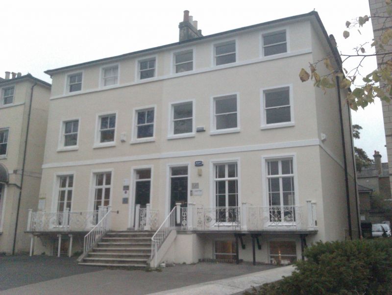
A Mid C19 pair. 3 storeys and semi-basement. Hipped slate roof. 4 sashes with
verticals only. Stringcourses. Between the ground and 1st floor is a balcony
with Vitruvian scroll and anthemion motifs in cast iron and a central Tuscan
porch having a staircase with cast iron balcony. Included for group value.
Nos 16 to 30 (even) form a group.
Listing NGR: TQ5828139480
External links are from the relevant listing authority and, where applicable, Wikidata. Wikidata IDs may be related buildings as well as this specific building. If you want to add or update a link, you will need to do so by editing the Wikidata entry.


Other nearby listed buildings
