Latitude: 53.6144 / 53°36'51"N
Longitude: -2.1579 / 2°9'28"W
OS Eastings: 389651
OS Northings: 413104
OS Grid: SD896131
Mapcode National: GBR FVCN.M2
Mapcode Global: WHB8X.TDMZ
Plus Code: 9C5VJR7R+QR
Entry Name: Sun Dial to South of Church of Saint Chad
Listing Date: 12 February 1985
Grade: II
Source: Historic England
Source ID: 1084270
English Heritage Legacy ID: 358871
ID on this website: 101084270
Location: St Chad's Church, Rochdale, Greater Manchester, OL16
County: Rochdale
Electoral Ward/Division: Milkstone and Deeplish
Parish: Non Civil Parish
Built-Up Area: Rochdale
Traditional County: Lancashire
Lieutenancy Area (Ceremonial County): Greater Manchester
Church of England Parish: Rochdale St Chad, St Mary and St Edmund
Church of England Diocese: Manchester
Tagged with: Building
SD 8913 SE ROCHDALE CHURCH STILE
(north-west side)
11/44 Sun dial to south of
Church of Saint Chad
G.V. II
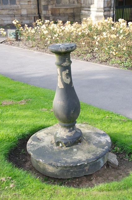
Sun-dial.1783. Stone. Baluster shaft on circular plinth
with nosing. Dial not in place. Formerly located on site
of present War Memorial. Included for group value.
Listing NGR: SD8965113104
External links are from the relevant listing authority and, where applicable, Wikidata. Wikidata IDs may be related buildings as well as this specific building. If you want to add or update a link, you will need to do so by editing the Wikidata entry.


Other nearby listed buildings