Approximate Location Map
Large Map »
Latitude: 51.1318 / 51°7'54"N
Longitude: 0.2593 / 0°15'33"E
OS Eastings: 558175
OS Northings: 139373
OS Grid: TQ581393
Mapcode National: GBR MPS.SH9
Mapcode Global: VHHQD.FTY7
Plus Code: 9F3247J5+PP
Entry Name: 62 and 63, London Road
Listing Date: 7 June 1974
Grade: II
Source: Historic England
Source ID: 1084483
English Heritage Legacy ID: 168045
ID on this website: 101084483
Location: Royal Tunbridge Wells, Tunbridge Wells, Kent, TN1
County: Kent
District: Tunbridge Wells
Electoral Ward/Division: Culverden
Parish: Non Civil Parish
Built-Up Area: Royal Tunbridge Wells
Traditional County: Kent
Lieutenancy Area (Ceremonial County): Kent
Church of England Parish: Tunbridge Wells Holy Trinity with Christ Church
Church of England Diocese: Rochester
Tagged with: Building
LONDON ROAD
1.
1746
Nos 62 and 65
TQ 5839 2/248
II GV
2.
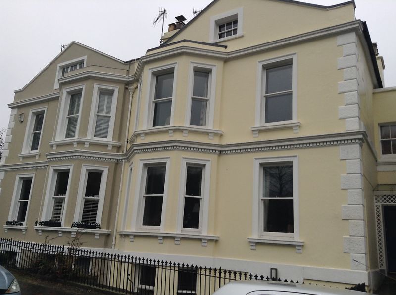
A mid C19 pair. 2 storeys basement and attics cement rendered. 2 gables with
1 window each. 1 sash and 1 3 light bay with sashes each. Moulded window surrounds.
Long and short quoins. Cast iron spear railings.
Nos 6O to 63 (consec) form a group.
Listing NGR: TQ5817439371
External links are from the relevant listing authority and, where applicable, Wikidata. Wikidata IDs may be related buildings as well as this specific building. If you want to add or update a link, you will need to do so by editing the Wikidata entry.


Other nearby listed buildings
