Latitude: 51.1469 / 51°8'48"N
Longitude: 0.4644 / 0°27'51"E
OS Eastings: 572469
OS Northings: 141515
OS Grid: TQ724415
Mapcode National: GBR PSP.46Q
Mapcode Global: VHJMZ.0FCM
Plus Code: 9F324FW7+QQ
Entry Name: Bainden Farmhouse
Listing Date: 10 October 1989
Grade: II
Source: Historic England
Source ID: 1084505
English Heritage Legacy ID: 169935
ID on this website: 101084505
Location: Tunbridge Wells, Kent, TN12
County: Kent
District: Tunbridge Wells
Civil Parish: Horsmonden
Traditional County: Kent
Lieutenancy Area (Ceremonial County): Kent
Church of England Parish: Horsmonden St Margaret
Church of England Diocese: Rochester
Tagged with: Farmhouse
HORSMONDEN SCHOOLHOUSE LANE TQ 74 SW (east side) 1/99 Bainden Farmhouse GV II
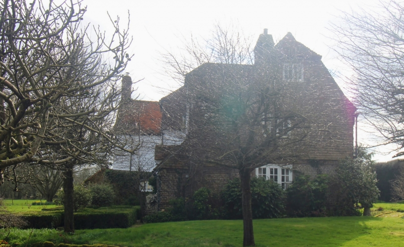
House. Late C16, altered and extended C17-C18 and late C20. Timber framed and clad with red brick on ground floor and tile hung on first floor with weather boarded rear wings. Plain tiled roof. Two storeys and garret on plinth with half-hipped roof with gablet to left and stacks to centre left and at end right. Two 3 light wooden casements on each floor with central 4 light casement on first floor and glazed door to centre left on ground floor and with C20 lean-to extension to right with wooden casements recessed in roof slope. Catslide outshot to rear with gabled 2 storey wing to rear right with end stack and C18 and C20 half-hipped wings. Interior: fully framed interior with cambered tie beams (roof space not inspected), large inglenook with timber bresummer and large kitchen fireplace in C17 gabled rear wing. C18 brick lined cellar.
Listing NGR: TQ7246941515
External links are from the relevant listing authority and, where applicable, Wikidata. Wikidata IDs may be related buildings as well as this specific building. If you want to add or update a link, you will need to do so by editing the Wikidata entry.


Other nearby listed buildings