Latitude: 51.1471 / 51°8'49"N
Longitude: 0.4646 / 0°27'52"E
OS Eastings: 572481
OS Northings: 141538
OS Grid: TQ724415
Mapcode National: GBR PSP.47R
Mapcode Global: VHJMZ.0FGG
Plus Code: 9F324FW7+RR
Entry Name: Barn, Now House with Outhouses About 20 Metres North West of Baiden Farm
Listing Date: 10 October 1989
Grade: II
Source: Historic England
Source ID: 1338786
English Heritage Legacy ID: 169936
ID on this website: 101338786
Location: Tunbridge Wells, Kent, TN12
County: Kent
District: Tunbridge Wells
Civil Parish: Horsmonden
Traditional County: Kent
Lieutenancy Area (Ceremonial County): Kent
Church of England Parish: Horsmonden St Margaret
Church of England Diocese: Rochester
Tagged with: Barn
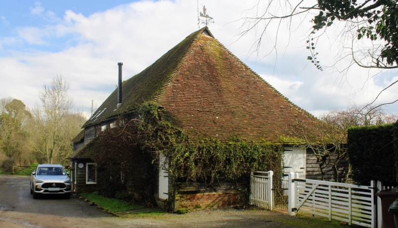
HORSMONDEN SCHOOLHOUSE LANE TQ 74 SW (east side) 1/100 Barn, now House with outhouses about 20 metres north west of Bainden Farm. GV II
Barn, now house with outhouses. Late C16, extended and altered late C18, converted late C20. Timber framed and weather boarded and extended with red and blue chequered brick. Plain tiled roofs. Main range on sandstone base, repaired with red brick and with roof hipped to right and gabled to left and stepped down to extension at left. Three cart doors in left hand extension and boarded door to centre of main block in C20 hipped porch, with 4 single lights on each floor. Catslide outshots to right and to rear with boarded half doors and recessed casements in roof slope. Interior: 5 bay barn with 2 bay extension. The frame is intact and unaltered, with queen strut and windbrace roof. The original central entrance bays with inward sloping shores to main posts probably C18 alterations as are the joists which converted the end bays to 2 storeys.
Listing NGR: TQ7246941515
External links are from the relevant listing authority and, where applicable, Wikidata. Wikidata IDs may be related buildings as well as this specific building. If you want to add or update a link, you will need to do so by editing the Wikidata entry.


Other nearby listed buildings