Latitude: 51.1008 / 51°6'2"N
Longitude: 0.393 / 0°23'34"E
OS Eastings: 567639
OS Northings: 136226
OS Grid: TQ676362
Mapcode National: GBR NRN.XVL
Mapcode Global: VHJN3.RLLG
Plus Code: 9F32492V+85
Entry Name: Outhouse About 1 Metre East of the Chequers Inn
Listing Date: 10 October 1989
Grade: II
Source: Historic England
Source ID: 1085291
English Heritage Legacy ID: 170072
ID on this website: 101085291
Location: Lamberhurst, Tunbridge Wells, Kent, TN3
County: Kent
District: Tunbridge Wells
Civil Parish: Lamberhurst
Built-Up Area: Lamberhurst
Traditional County: Sussex
Lieutenancy Area (Ceremonial County): Kent
Church of England Parish: Lamberhurst St Mary
Church of England Diocese: Rochester
Tagged with: Outhouse
LAMBERHURST THE BROADWAY
TQ 6636-6736
(east side)
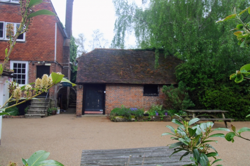
8/235 Outhouse about 1 metre
east of The Chequers Inn
GV II
Outhouse. C18. Red brick with weather boarded gables and plain tiled roof. Single
storey with half-hipped roof. Boarded door to left and shuttered window opening to
right.
Listing NGR: TQ6763936226
External links are from the relevant listing authority and, where applicable, Wikidata. Wikidata IDs may be related buildings as well as this specific building. If you want to add or update a link, you will need to do so by editing the Wikidata entry.


Other nearby listed buildings