Latitude: 51.335 / 51°20'6"N
Longitude: 1.4239 / 1°25'26"E
OS Eastings: 638593
OS Northings: 165115
OS Grid: TR385651
Mapcode National: GBR X0M.6TH
Mapcode Global: VHMCW.MPMY
Plus Code: 9F338CPF+2H
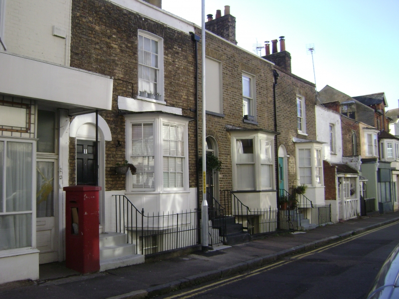
Entry Name: Nos 7, 9 and 11 Railed Areas
Listing Date: 4 February 1988
Grade: II
Source: Historic England
Source ID: 1085425
English Heritage Legacy ID: 171683
ID on this website: 101085425
Location: Ramsgate, Thanet, Kent, CT11
County: Kent
District: Thanet
Civil Parish: Ramsgate
Built-Up Area: Ramsgate
Traditional County: Kent
Lieutenancy Area (Ceremonial County): Kent
Tagged with: Building
RAMSGATE BELLEVUE ROAD TR 3865 SE (east side) 10/54 Nos. 7, 9 and 11 railed areas GV II Terrace row. Circa 1820. Stock brick slate roofs. 2 storeys and basement with parapet and stacks ranged left to right. Cambered glazing bar sash, blank window recess, sash and glazing bar sash on first floor, and canted bays on ground floor (all 3 of slightly different size and pattern), all with moulded and reeded surrounds. Doors of 6 panels, half-glazed and of reeded panels (probably the original pattern) in part glazed, all with semi-circular surrounds, the centre with a fanlight. Glazing bar sashes to basements, with central half-glazed doors, and simple rails to Areas. Marked on Collard and Hurst's 1822 plan of Ramsgate.
Listing NGR: TR3859365115
External links are from the relevant listing authority and, where applicable, Wikidata. Wikidata IDs may be related buildings as well as this specific building. If you want to add or update a link, you will need to do so by editing the Wikidata entry.


Other nearby listed buildings