Approximate Location Map
Large Map »
Latitude: 51.3301 / 51°19'48"N
Longitude: 1.4152 / 1°24'54"E
OS Eastings: 638008
OS Northings: 164533
OS Grid: TR380645
Mapcode National: GBR X0L.JLG
Mapcode Global: VHMCW.HT0R
Plus Code: 9F338CJ8+23
Entry Name: No 71 and Railed Area
Listing Date: 4 February 1988
Grade: II
Source: Historic England
Source ID: 1085452
English Heritage Legacy ID: 171655
ID on this website: 101085452
Location: Ramsgate, Thanet, Kent, CT11
County: Kent
District: Thanet
Civil Parish: Ramsgate
Built-Up Area: Ramsgate
Traditional County: Kent
Lieutenancy Area (Ceremonial County): Kent
Tagged with: Building
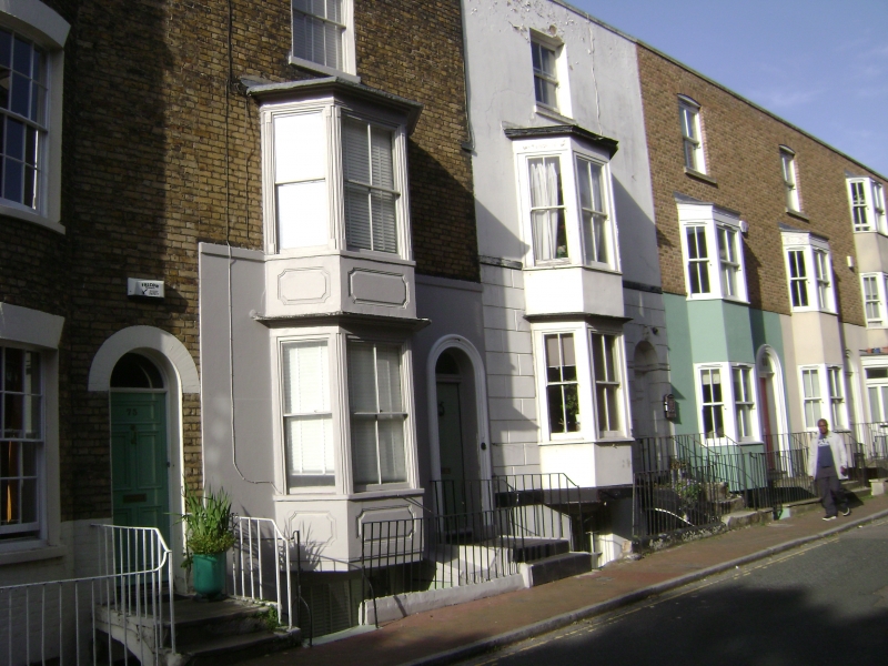
RAMSGATE ADDINGTON STREET
TR 3864 NW
(west side)
13/25 No. 71 and railed
Area
GV II
House. Circa 1830. Rendered with tiled roof. Three storeys and basement
with rusticated base, parapet and rear stack. Sash on 2nd floor; 2 storey
canted bay to ground and first floors, with sashes. Panelled door to right
with top 2 panels glazed, with semi-circular headed surround with Coade stone
keystone. Three steps with swept rails, and simple rails and wrought gate
to basement area, with glazing bar sash to basement.
Listing NGR: TR3800864533
External links are from the relevant listing authority and, where applicable, Wikidata. Wikidata IDs may be related buildings as well as this specific building. If you want to add or update a link, you will need to do so by editing the Wikidata entry.


Other nearby listed buildings
