Latitude: 51.2579 / 51°15'28"N
Longitude: 1.018 / 1°1'4"E
OS Eastings: 610678
OS Northings: 155299
OS Grid: TR106552
Mapcode National: GBR TYD.06Z
Mapcode Global: VHKK4.LNK1
Plus Code: 9F337259+56
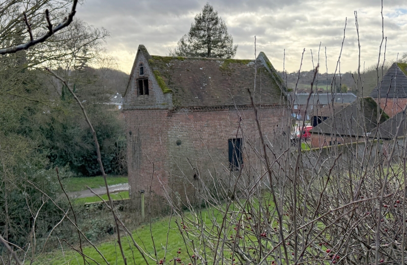
Entry Name: Barn at Burnt House Farm Situated to North of Farmhouse
Listing Date: 14 March 1980
Grade: II
Source: Historic England
Source ID: 1085674
English Heritage Legacy ID: 171060
ID on this website: 101085674
Location: Chartham, Canterbury, Kent, CT4
County: Kent
District: Canterbury
Civil Parish: Chartham
Built-Up Area: Shalmsford Street
Traditional County: Kent
Lieutenancy Area (Ceremonial County): Kent
Tagged with: Barn
1. 5273 CHARTHAM ASHFORD ROAD
Barn at Burnt House Farm situated to north of Farmhouse TR 1055 29/224A
II GV
2. C18 or earlier. Built of red brick with loop lights. Tiled roof with projecting hip over the waggon entrance on the south side and queen-posts inside, the uprights now propped up by brick walls.
Listing NGR: TR1067655300
External links are from the relevant listing authority and, where applicable, Wikidata. Wikidata IDs may be related buildings as well as this specific building. If you want to add or update a link, you will need to do so by editing the Wikidata entry.


Other nearby listed buildings