Latitude: 51.2074 / 51°12'26"N
Longitude: 1.1624 / 1°9'44"E
OS Eastings: 620990
OS Northings: 150108
OS Grid: TR209501
Mapcode National: GBR W0H.6Q5
Mapcode Global: VHLGW.3XC8
Plus Code: 9F336546+XX
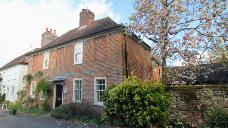
Entry Name: Court Cottage
Listing Date: 30 January 1967
Last Amended: 14 March 1980
Grade: II
Source: Historic England
Source ID: 1085715
English Heritage Legacy ID: 170956
ID on this website: 101085715
Location: Barham, Canterbury, Kent, CT4
County: Kent
District: Canterbury
Civil Parish: Barham
Built-Up Area: Barham
Traditional County: Kent
Lieutenancy Area (Ceremonial County): Kent
Tagged with: Cottage
1. 5273 BARHAM THE STREET (north side)
Court Cottage (formerly listed under Rectory Lane) TR 2050 24/81 30.1.67
II GV
2. Early C19. Two storeys in red brick with hipped tile roof and moulded wood eaves cornice. Five window spaces, the outer and centre blank, two with hung sashes with glazing bars. Four windows to ground floor and door of four panels with wide flat hood. Flush stringcourse of grey headers.
Listing NGR: TR2099050108
External links are from the relevant listing authority and, where applicable, Wikidata. Wikidata IDs may be related buildings as well as this specific building. If you want to add or update a link, you will need to do so by editing the Wikidata entry.


Other nearby listed buildings