Approximate Location Map
Large Map »
Latitude: 51.2759 / 51°16'33"N
Longitude: 0.1076 / 0°6'27"E
OS Eastings: 547105
OS Northings: 155080
OS Grid: TQ471550
Mapcode National: GBR LLH.XPL
Mapcode Global: VHHPQ.T687
Plus Code: 9F3274G5+92
Entry Name: Garden Walls to West of the Mount House
Listing Date: 10 September 1954
Grade: II
Source: Historic England
Source ID: 1085838
English Heritage Legacy ID: 356926
ID on this website: 101085838
Location: Brasted, Sevenoaks, Kent, TN16
County: Kent
District: Sevenoaks
Civil Parish: Brasted
Built-Up Area: Brasted
Traditional County: Kent
Lieutenancy Area (Ceremonial County): Kent
Church of England Parish: Brasted St Martin
Church of England Diocese: Rochester
Tagged with: Wall
1.
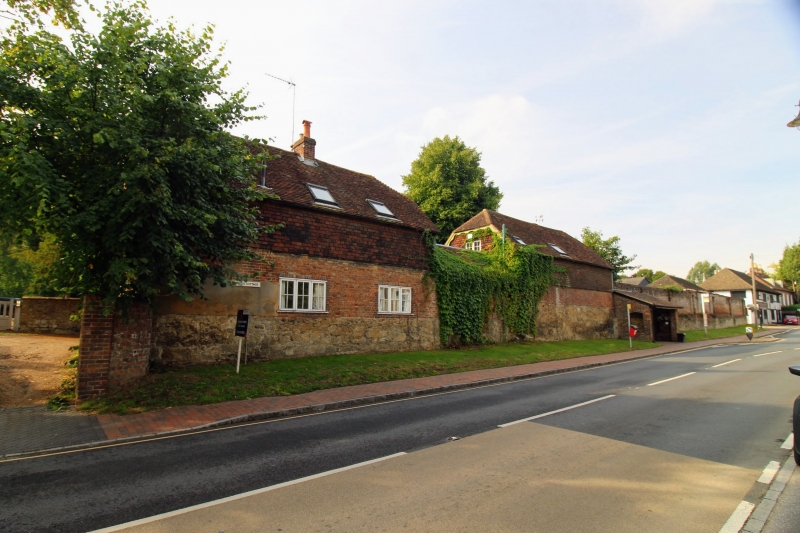
5280 BRASTED BRASTED
High Street
(South Side)
Garden Walls to
West of the Mount House
TQ 4755 2/63 10.9.54.
II
2.
Long C18 brick wall with random stone base forming boundary of kitchen gardens
and running from stable yard entrance to Chart Lane corner and continued up
Chart Lane for about 100 yards.
Listing NGR: TQ4710555080
External links are from the relevant listing authority and, where applicable, Wikidata. Wikidata IDs may be related buildings as well as this specific building. If you want to add or update a link, you will need to do so by editing the Wikidata entry.


Other nearby listed buildings
