Latitude: 51.2758 / 51°16'32"N
Longitude: 0.1072 / 0°6'25"E
OS Eastings: 547073
OS Northings: 155072
OS Grid: TQ470550
Mapcode National: GBR LLH.XKR
Mapcode Global: VHHPQ.T609
Plus Code: 9F3274G4+8V
Entry Name: The Village House
Listing Date: 10 September 1954
Grade: II
Source: Historic England
Source ID: 1249447
English Heritage Legacy ID: 356927
ID on this website: 101249447
Location: Brasted, Sevenoaks, Kent, TN16
County: Kent
District: Sevenoaks
Civil Parish: Brasted
Built-Up Area: Brasted
Traditional County: Kent
Lieutenancy Area (Ceremonial County): Kent
Church of England Parish: Brasted St Martin
Church of England Diocese: Rochester
Tagged with: House
1. 5280 BRASTED BRASTED High Street (South Side) The Village House TQ 4755 2/64 10.9.54.
II
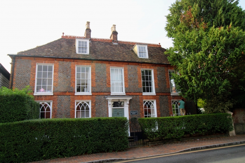
2. Mid C18 house with alterations. 2 storeys and attic, 3 windows. Fairly high pitched tiled roof half-hipped at right, with 2 dormers, C18 sashes in moulded frames. Walls of blue headers with red brick dressings, ie moulded eaves cornice, quoins, band and window dressings including flat gauged brick arches. Rendered plinth. Early C19 sash windows with glazing bars in stucco lined reveals, those on ground with Gothic tracery. Reproduction 8-panel door, with rectangular fnanlight, in moulded frame. Bracketed hood on pilasters. At back remains of a C17 U-shaped house incorporated into the C18 one.
Listing NGR: TQ4707355072
External links are from the relevant listing authority and, where applicable, Wikidata. Wikidata IDs may be related buildings as well as this specific building. If you want to add or update a link, you will need to do so by editing the Wikidata entry.


Other nearby listed buildings