Approximate Location Map
Large Map »
Latitude: 51.277 / 51°16'37"N
Longitude: 0.1958 / 0°11'44"E
OS Eastings: 553250
OS Northings: 155382
OS Grid: TQ532553
Mapcode National: GBR MMY.VQH
Mapcode Global: VHHPS.B5VD
Plus Code: 9F3275GW+Q8
Entry Name: Mount Hermon
Listing Date: 29 September 1972
Grade: II
Source: Historic England
Source ID: 1085959
English Heritage Legacy ID: 172259
ID on this website: 101085959
Location: Sevenoaks, Kent, TN13
County: Kent
District: Sevenoaks
Civil Parish: Sevenoaks
Built-Up Area: Sevenoaks
Traditional County: Kent
Lieutenancy Area (Ceremonial County): Kent
Church of England Parish: Sevenoaks St John the Baptist
Church of England Diocese: Rochester
Tagged with: Building
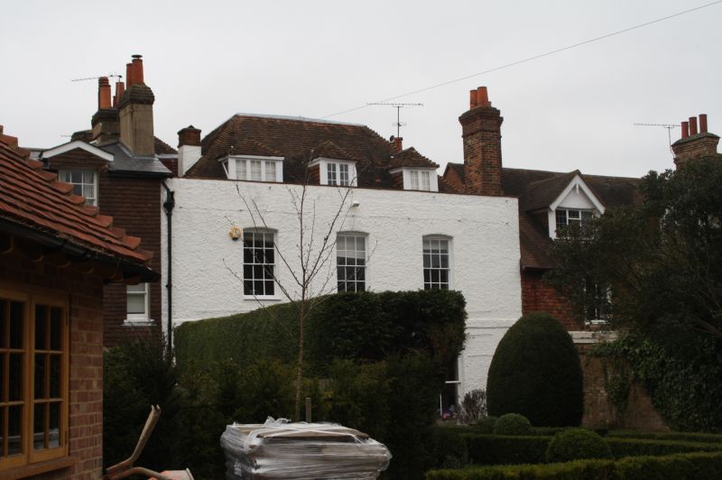
PARK LANE
1.
1614
(North Side)
No 2
(Mount Hermon)
TQ 5355/2/95
II
2.
C18. 3-window facade. 2 storeys. Rough cast elevation with parapet and
hipped tiled roof with 3 tiled dormers. Plinth and band. Centre glazed
door with fanlight and flat projecting moulded hood over with flat carved
brackets. 2 C19 sash windows on 1st floor with glazing bars. Large modern
additions adjoining now converted into separate house.
Listing NGR: TQ5325055382
External links are from the relevant listing authority and, where applicable, Wikidata. Wikidata IDs may be related buildings as well as this specific building. If you want to add or update a link, you will need to do so by editing the Wikidata entry.


Other nearby listed buildings
