Latitude: 51.3294 / 51°19'45"N
Longitude: 1.4127 / 1°24'45"E
OS Eastings: 637837
OS Northings: 164452
OS Grid: TR378644
Mapcode National: GBR X0L.PYP
Mapcode Global: VHMCW.FVP8
Plus Code: 9F338CH7+Q3
Entry Name: Nos 5 and 6 with Railed Areas
Listing Date: 4 February 1988
Grade: II
Source: Historic England
Source ID: 1086096
English Heritage Legacy ID: 172007
ID on this website: 101086096
Location: Ramsgate, Thanet, Kent, CT11
County: Kent
District: Thanet
Civil Parish: Ramsgate
Built-Up Area: Ramsgate
Traditional County: Kent
Lieutenancy Area (Ceremonial County): Kent
Tagged with: Building Double house
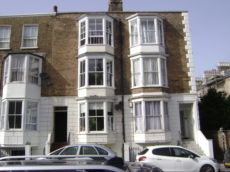
RAMSGATE ST. AUGUSTINE'S ROAD
TR 3764 SE
(north side)
18/371 Nos. 5 and 6 with
railed areas.
GV II
House pair. 1840's. Stock brick with rendered base and with slate roof.
Three storeys and basement with rusticated base. Rusticated quoins to right
and parapet to roof with central stack. Two central 3 storey canted bays
with half glazed door to left and glazed door to right, both with rectangular
fanlights, keyed head to left and flights of 6 steps. Sashes with
vertical glazing bars intact to basements. Simple rails to steps,
fleur-de-lys to basement areas.
Listing NGR: TR3783864453
External links are from the relevant listing authority and, where applicable, Wikidata. Wikidata IDs may be related buildings as well as this specific building. If you want to add or update a link, you will need to do so by editing the Wikidata entry.


Other nearby listed buildings