Approximate Location Map
Large Map »
Latitude: 51.2735 / 51°16'24"N
Longitude: 0.5273 / 0°31'38"E
OS Eastings: 576383
OS Northings: 155734
OS Grid: TQ763557
Mapcode National: GBR PR7.24Y
Mapcode Global: VHJMF.3833
Plus Code: 9F327GFG+9W
Entry Name: 70, King Street
Listing Date: 2 August 1974
Grade: II
Source: Historic England
Source ID: 1086325
English Heritage Legacy ID: 173375
ID on this website: 101086325
Location: Maidstone, Kent, ME14
County: Kent
District: Maidstone
Electoral Ward/Division: High Street
Parish: Non Civil Parish
Built-Up Area: Maidstone
Traditional County: Kent
Lieutenancy Area (Ceremonial County): Kent
Tagged with: Building
KING STREET
1.
5278
(South Side)
No 70
TQ 7655 NW 2/291
II GV
2.
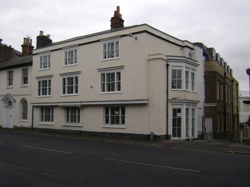
A timber-framed building refronted but retaining traces of an overhang and
bressumer. 3 storeys painted brick. Hipped tiled roof. 3 triple sashes to front
elevation. The right side elevation contains the door, set in a 4-light mid
C19 bay through all floors. The interior contains exposed beams and the ground
floor has some good Cl7 panelling.
Nos 70 to 86 (even) form a group.
Listing NGR: TQ7637855725
External links are from the relevant listing authority and, where applicable, Wikidata. Wikidata IDs may be related buildings as well as this specific building. If you want to add or update a link, you will need to do so by editing the Wikidata entry.


Other nearby listed buildings
