Approximate Location Map
Large Map »
Latitude: 51.2747 / 51°16'29"N
Longitude: 0.5217 / 0°31'17"E
OS Eastings: 575985
OS Northings: 155864
OS Grid: TQ759558
Mapcode National: GBR PR7.0Q1
Mapcode Global: VHJMF.0743
Plus Code: 9F327GFC+VM
Entry Name: 21 and 23, Earl Street
Listing Date: 2 August 1974
Grade: II
Source: Historic England
Source ID: 1086370
English Heritage Legacy ID: 173292
ID on this website: 101086370
Location: Maidstone, Kent, ME14
County: Kent
District: Maidstone
Electoral Ward/Division: High Street
Parish: Non Civil Parish
Built-Up Area: Maidstone
Traditional County: Kent
Lieutenancy Area (Ceremonial County): Kent
Tagged with: Building
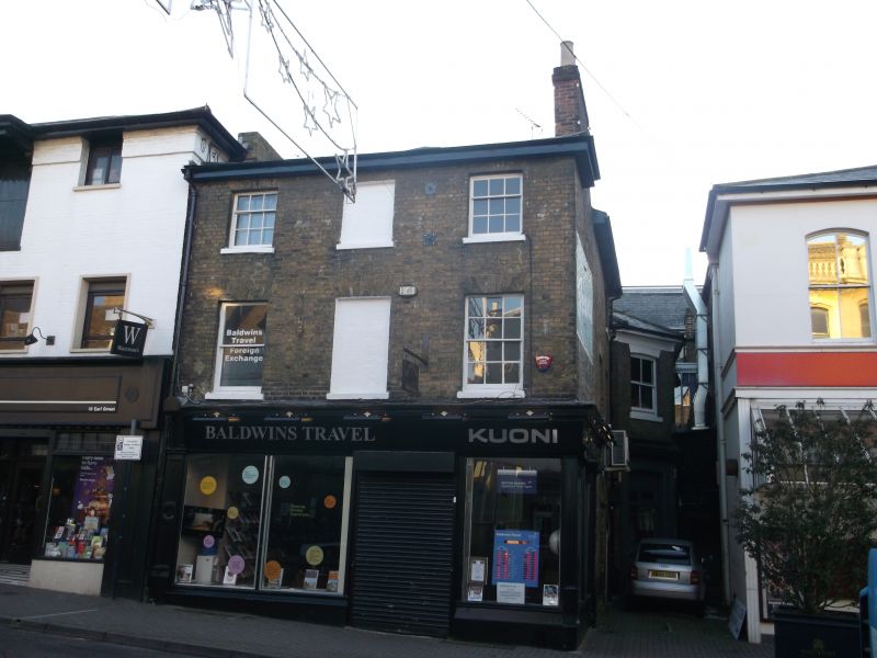
EARL STREET
1.
5278
(South Side)
Nos 21 and 23
TQ 7555 NE 1/237
II
2.
Early to Mid C19. 3 storeys stock brick. Hipped slate roof. Eaves cornice.
2 sashes and central blank. Glazing bars intact. Mid C19 shop front.
Listing NGR: TQ7598755862
External links are from the relevant listing authority and, where applicable, Wikidata. Wikidata IDs may be related buildings as well as this specific building. If you want to add or update a link, you will need to do so by editing the Wikidata entry.


Other nearby listed buildings
