Latitude: 54.2214 / 54°13'17"N
Longitude: -3.2718 / 3°16'18"W
OS Eastings: 317174
OS Northings: 481380
OS Grid: SD171813
Mapcode National: GBR 5MLM.GH
Mapcode Global: WH722.Q563
Plus Code: 9C6R6PCH+H7
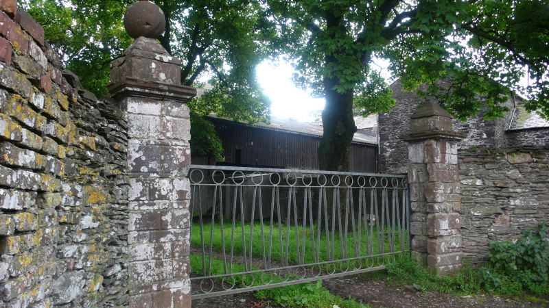
Entry Name: Gatepiers to North East of Millom Castle
Listing Date: 14 July 1989
Grade: II
Source: Historic England
Source ID: 1086620
English Heritage Legacy ID: 76335
ID on this website: 101086620
Location: Cumberland, Cumbria, LA18
County: Cumbria
District: Copeland
Town: Copeland
Civil Parish: Millom
Traditional County: Cumberland
Lieutenancy Area (Ceremonial County): Cumbria
Church of England Parish: Millom
Church of England Diocese: Carlisle
Tagged with: Gatepost
MILLOM A5093 SD 18 SE (south side) 13/35 Gatepiers to ,north-east of Millom Castle GV II Gatepiers to road. Probably Cl7 or C18. Ashlar. Rusticated square piers with cornices and ball finials.
Listing NGR: SD1717681380
External links are from the relevant listing authority and, where applicable, Wikidata. Wikidata IDs may be related buildings as well as this specific building. If you want to add or update a link, you will need to do so by editing the Wikidata entry.


Other nearby listed buildings