Latitude: 52.3382 / 52°20'17"N
Longitude: -1.5338 / 1°32'1"W
OS Eastings: 431862
OS Northings: 271222
OS Grid: SP318712
Mapcode National: GBR 6MY.925
Mapcode Global: VHBXB.CHJF
Plus Code: 9C4W8FQ8+7F
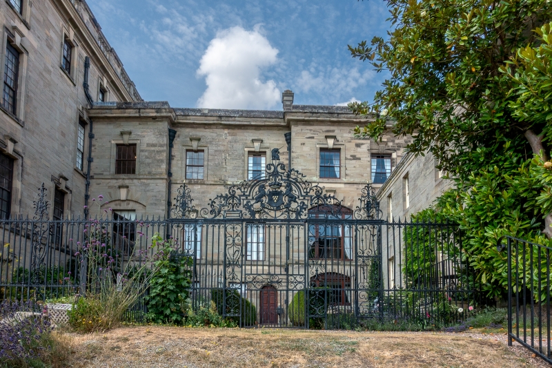
Entry Name: Iron Gate and Screen 11 Yards to South of South Wing of Stoneleigh Abbey
Listing Date: 23 January 1987
Grade: II*
Source: Historic England
Source ID: 1086942
English Heritage Legacy ID: 308146
ID on this website: 101086942
Location: Warwick, Warwickshire, CV8
County: Warwickshire
District: Warwick
Civil Parish: Stoneleigh
Built-Up Area: Stoneleigh Park
Traditional County: Warwickshire
Lieutenancy Area (Ceremonial County): Warwickshire
Church of England Parish: Stoneleigh St Mary the Virgin
Church of England Diocese: Coventry
Tagged with: Architectural structure
STONELEIGH 6/274 Iron Gate and Screen 11 yards to south of South - Wing of Stoneleigh Abbey
GV II*
1770 wrought iron gate and screen between west and east wings of The Abbey. Contain the arms of the Third Lord Leigh and his wife, Mary Holbech, in the overthrow.
Listing NGR: SP3186271223
External links are from the relevant listing authority and, where applicable, Wikidata. Wikidata IDs may be related buildings as well as this specific building. If you want to add or update a link, you will need to do so by editing the Wikidata entry.


Other nearby listed buildings