Latitude: 54.2068 / 54°12'24"N
Longitude: -2.9438 / 2°56'37"W
OS Eastings: 338536
OS Northings: 479412
OS Grid: SD385794
Mapcode National: GBR 7MWS.GR
Mapcode Global: WH83C.RJCD
Plus Code: 9C6V6344+PF
Entry Name: Borwicks Aynsome Farmhouse with Attached Outbuildings
Listing Date: 25 March 1970
Grade: II
Source: Historic England
Source ID: 1087216
English Heritage Legacy ID: 76916
ID on this website: 101087216
Location: Cartmel, Westmorland and Furness, Cumbria, LA11
County: Westmorland and Furness
District: South Lakeland
Civil Parish: Broughton East
Traditional County: Lancashire
Lieutenancy Area (Ceremonial County): Cumbria
Church of England Parish: Cartmel St Mary and St Michael
Church of England Diocese: Carlisle
Tagged with: Farmhouse
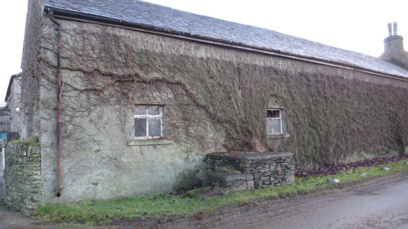
BROUGHTON EAST CARTMEL SD 37 NE 5/7 Borwicks Aynsome 25.3.70 Farmhouse with attached outbuildings II Farmhouse and outbuilding. Late C17 or C18. Roughcast stone with slate roof. 2 storeys, 5 bays; long outbuilding to north, the end bay now part of house. Moulded gutter. Windows of 2 lights with flat mullions in hollow-chamfered openings. Central entrance with half-glazed door. Windows to south end of outbuilding have casements; north end, probably later, has 2 casement windows and mounting block attached. Gable-end stacks. Rear wing has attached barn and cat-slide outshut to north; 2 windows to south return of 3 lights, others have casements. Cross-axial stack and stack in roof slope. Barn to east has barn doors and small entrance to cow house; outbuilding to north has barn entrance, entrance and window to south and 2 cow house entrances with pitching hole to north end.
Listing NGR: SD3853679412
External links are from the relevant listing authority and, where applicable, Wikidata. Wikidata IDs may be related buildings as well as this specific building. If you want to add or update a link, you will need to do so by editing the Wikidata entry.


Other nearby listed buildings