Latitude: 54.3511 / 54°21'3"N
Longitude: -2.9425 / 2°56'32"W
OS Eastings: 338838
OS Northings: 495472
OS Grid: SD388954
Mapcode National: GBR 7LW4.R0
Mapcode Global: WH82L.SW0R
Plus Code: 9C6V9325+C2
Entry Name: The Station
Listing Date: 25 March 1970
Grade: II
Source: Historic England
Source ID: 1087305
English Heritage Legacy ID: 76726
ID on this website: 101087305
Location: Far Sawrey, Westmorland and Furness, Cumbria, LA22
County: Cumbria
District: South Lakeland
Civil Parish: Claife
Traditional County: Lancashire
Lieutenancy Area (Ceremonial County): Cumbria
Church of England Parish: Sawrey St Peter
Church of England Diocese: Carlisle
Tagged with: Building
CLAIFE B5285 (North side) SD 39 NE Far Sawrey The Station 6/51 25.3.70
II
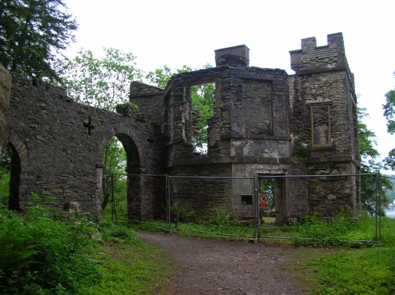
Viewing station. Late C18. Stone rubble. 2 storeys, with canted bays to front and rear, and embattled parapet. Now ruinous, the front wall collapsed. lst floor sill band, some slate hanging remains to rear. Large window openings to 1st floor of returns and narrow opening to remaining part of front wall. Lower recesses to ground floor of returns. Rear has canted bay with entrance and 1st floor window opening with flanking blind windows; narrow window openings to either side, with slate hanging to remains of parapet. Wall connects station with rock outcrop to rear, with round-headed archway and round-headed opening with foundations of structure to rear. Interior has remains of cross walls, rear gabled wall with stack and fireplace. Vaulted chamber to ground floor, rear canted bay has stone flying stair with moulded treads. The Station was used as a viewing point for Lake Windermere at the time when picturesque principles suggested that landscape should be viewed from certain points only, where the elements of scenery were most pictorial, and is associated with the early tourist industry. Property of The National Trust.
Listing NGR: SD3883895472
External links are from the relevant listing authority and, where applicable, Wikidata. Wikidata IDs may be related buildings as well as this specific building. If you want to add or update a link, you will need to do so by editing the Wikidata entry.


Other nearby listed buildings