Approximate Location Map
Large Map »
Latitude: 54.183 / 54°10'58"N
Longitude: -2.6733 / 2°40'23"W
OS Eastings: 356158
OS Northings: 476564
OS Grid: SD561765
Mapcode National: GBR 9NS2.18
Mapcode Global: WH83P.X463
Plus Code: 9C6V58MG+5M
Entry Name: Boundary Stone Between Dalton and Hutton Roof
Listing Date: 22 October 1985
Grade: II
Source: Historic England
Source ID: 1087323
English Heritage Legacy ID: 76670
ID on this website: 101087323
Location: Westmorland and Furness, Cumbria, LA6
County: Cumbria
District: South Lakeland
Civil Parish: Burton-in-Kendal
Traditional County: Westmorland
Lieutenancy Area (Ceremonial County): Cumbria
Church of England Parish: Kirkby Lonsdale Team Ministry
Church of England Diocese: Carlisle
Tagged with: Boundary marker
5166 DALTON
SD 57 NE
SD 5615-7657
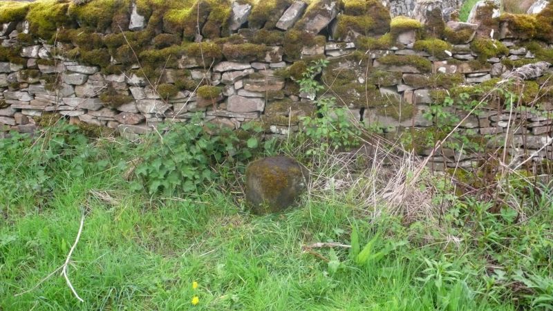
3/31 Boundary stone
between Dalton and
Hutton Roof
II
Boundary Stone. Probably early C19. Limestone. Upright stone with round head
and deep chamfers to front corners. Inscribed:
HUTTON on East and DALTON on West
ROOF
Bench mark on top.
Listing NGR: SD5615876564
External links are from the relevant listing authority and, where applicable, Wikidata. Wikidata IDs may be related buildings as well as this specific building. If you want to add or update a link, you will need to do so by editing the Wikidata entry.


Other nearby listed buildings
