Latitude: 53.1417 / 53°8'30"N
Longitude: -1.8103 / 1°48'36"W
OS Eastings: 412788
OS Northings: 360520
OS Grid: SK127605
Mapcode National: GBR 477.53J
Mapcode Global: WHCDK.597C
Plus Code: 9C5W45RQ+MV
Entry Name: Springfield House
Listing Date: 27 July 1984
Grade: II
Source: Historic England
Source ID: 1087849
English Heritage Legacy ID: 80548
ID on this website: 101087849
Location: Hartington, Derbyshire Dales, Derbyshire, SK17
County: Derbyshire
District: Derbyshire Dales
Civil Parish: Hartington Town Quarter
Traditional County: Derbyshire
Lieutenancy Area (Ceremonial County): Derbyshire
Church of England Parish: Hartington St Giles
Church of England Diocese: Derby
Tagged with: House
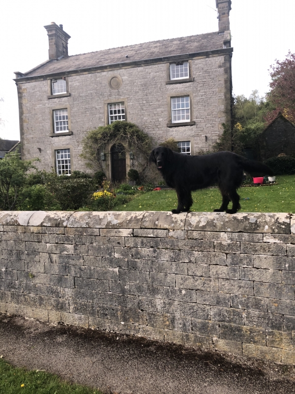
PARISH OF HARTINGTON TOWN QUARTER DIG STREET SK 12 60 12/118 (East Side) Springfield House GV II House. 1790. Coursed squared limestone with flush gritstone dressings and quoins. Moulded eaves cornice. Slate roof. Large C19 stone gable end stacks with plain fillets and overhanging cornices. Stone coped gables with plain kneelers. Three storeys, three bays. Central semi circular headed door with stepped jambs and projecting impost blocks. Flat hood on tall brackets. To either side, glazing bar sashes in flush surrounds. Three similar windows over. Two similar, shallower, windows to eaves, between them a circular plaque, inscribed '1790'. Rear elevation has central stairwell window through three floors with four transoms. Single storey addition to east. 2-light flush mullion window to west. Two similar windows either side of staircase above.
Listing NGR: SK1278860520
External links are from the relevant listing authority and, where applicable, Wikidata. Wikidata IDs may be related buildings as well as this specific building. If you want to add or update a link, you will need to do so by editing the Wikidata entry.


Other nearby listed buildings