Latitude: 52.0138 / 52°0'49"N
Longitude: -1.7618 / 1°45'42"W
OS Eastings: 416441
OS Northings: 235072
OS Grid: SP164350
Mapcode National: GBR 4NV.RCP
Mapcode Global: VHB19.DNY1
Plus Code: 9C4W267Q+G7
Entry Name: Raised Pavement
Listing Date: 26 August 1983
Grade: II
Source: Historic England
Source ID: 1088562
English Heritage Legacy ID: 126877
ID on this website: 101088562
Location: Blockley, Cotswold, Gloucestershire, GL56
County: Gloucestershire
District: Cotswold
Civil Parish: Blockley
Built-Up Area: Blockley
Traditional County: Gloucestershire
Lieutenancy Area (Ceremonial County): Gloucestershire
Church of England Parish: Blockley St Peter and St Paul
Church of England Diocese: Gloucester
Tagged with: Building
SP 1635 6/153 BLOCKLEY ST GEORGE'S TERRACE
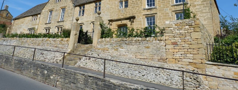
Raised Pavement GV II Mid C19, mason Richard Belcher (contemporary parish Waywarden). Runs from Elm Villa to No 2 St George's Terrace where it slopes down. Coursed rubble with simple tubular iron guard.
Listing NGR: SP1644135072
External links are from the relevant listing authority and, where applicable, Wikidata. Wikidata IDs may be related buildings as well as this specific building. If you want to add or update a link, you will need to do so by editing the Wikidata entry.


Other nearby listed buildings