Latitude: 51.6371 / 51°38'13"N
Longitude: -2.3556 / 2°21'20"W
OS Eastings: 375488
OS Northings: 193205
OS Grid: ST754932
Mapcode National: GBR 0MD.C8B
Mapcode Global: VH95G.431T
Plus Code: 9C3VJJPV+RQ
Entry Name: 26, Haw Street
Listing Date: 23 June 1952
Grade: II
Source: Historic England
Source ID: 1088928
English Heritage Legacy ID: 128133
ID on this website: 101088928
Location: Wotton-under-Edge, Stroud, Gloucestershire, GL12
County: Gloucestershire
District: Stroud
Civil Parish: Wotton-under-Edge
Built-Up Area: Wotton-under-Edge
Traditional County: Gloucestershire
Lieutenancy Area (Ceremonial County): Gloucestershire
Church of England Parish: Wotton-under-Edge with Ozleworth
Church of England Diocese: Gloucester
Tagged with: Building
ST 7693 4/64 WOTTON-UNDER-EDGE HAW STREET 23.6.52 (east)
No. 26 GV II
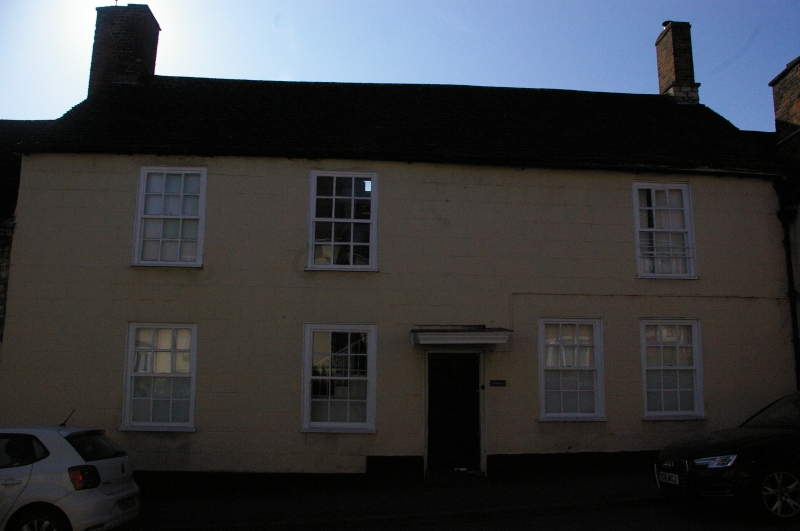
Dwelling. Mid C18. Rendered and ashlared, stone slate roof. Broad fronted block probably built as two cottages, plus return unit with half-hip to street, right end. Base of stack, right, cut stone. Two storeys, four plus one bays. Early sashes with square panes and broad glazing bars; one window block, top floor; one three-light casement in right gable plus small fixed light set low. Six panel fielded door and flat hood without brackets. Nos 22, 24 and 26 form an important introductory group to the street.
Listing NGR: ST7548893205
External links are from the relevant listing authority and, where applicable, Wikidata. Wikidata IDs may be related buildings as well as this specific building. If you want to add or update a link, you will need to do so by editing the Wikidata entry.


Other nearby listed buildings