Latitude: 51.3897 / 51°23'23"N
Longitude: 1.3818 / 1°22'54"E
OS Eastings: 635381
OS Northings: 171060
OS Grid: TR353710
Mapcode National: GBR WZS.VJZ
Mapcode Global: VHLG6.WBWG
Plus Code: 9F3399QJ+VP
Entry Name: 2, Duke Street
Listing Date: 22 February 1973
Grade: II
Source: Historic England
Source ID: 1088957
English Heritage Legacy ID: 356527
ID on this website: 101088957
Location: Margate, Thanet, Kent, CT9
County: Kent
District: Thanet
Electoral Ward/Division: Margate Central
Parish: Non Civil Parish
Built-Up Area: Margate
Traditional County: Kent
Lieutenancy Area (Ceremonial County): Kent
Tagged with: Building
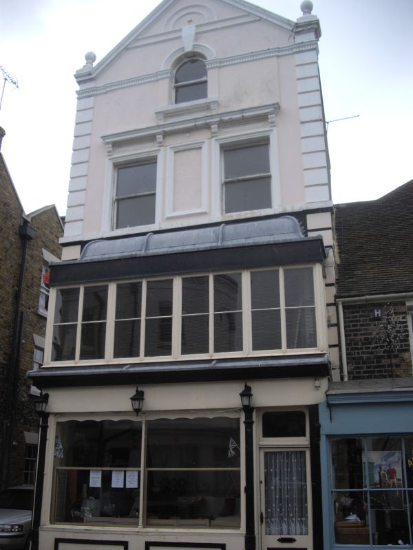
DUKE STREET
1.
1380
(North Side)
No 2
TR 3571 SW 2/147
II GV
2.
Mid C19. 3 storeys and attics stuccoed. Stock brick side wall. Pedimented
gable having 3 ball finials. 2 sashes. Balcony with hood on 1st floor.
The ground floor has an early C19 shopfront and a right side doorcase with rectangular fanlight.
Nos 2 to 10 (even) form a group
Listing NGR: TR3538171059
External links are from the relevant listing authority and, where applicable, Wikidata. Wikidata IDs may be related buildings as well as this specific building. If you want to add or update a link, you will need to do so by editing the Wikidata entry.


Other nearby listed buildings