Approximate Location Map
Large Map »
Latitude: 51.3897 / 51°23'23"N
Longitude: 1.3816 / 1°22'53"E
OS Eastings: 635361
OS Northings: 171061
OS Grid: TR353710
Mapcode National: GBR WZS.VGD
Mapcode Global: VHLG6.WBQG
Plus Code: 9F3399QJ+VJ
Entry Name: 6 and 8, Duke Street
Listing Date: 22 February 1973
Grade: II
Source: Historic England
Source ID: 1254722
English Heritage Legacy ID: 356529
ID on this website: 101254722
Location: Margate, Thanet, Kent, CT9
County: Kent
District: Thanet
Electoral Ward/Division: Margate Central
Parish: Non Civil Parish
Built-Up Area: Margate
Traditional County: Kent
Lieutenancy Area (Ceremonial County): Kent
Tagged with: Building
DUKE STREET
1,
1380
(North Side)
Nos 6 and 8
TR 3571 SW 2/12
II GV
2.
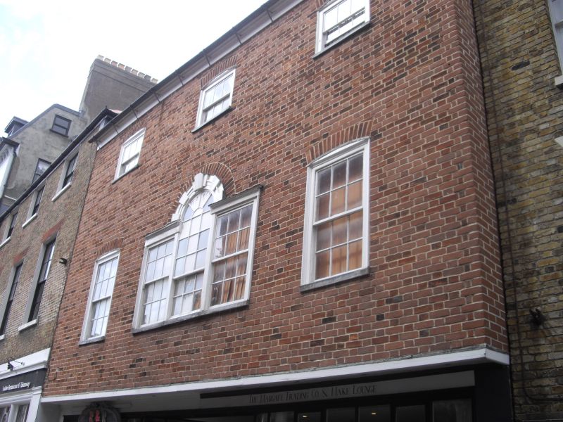
C18. 3 storeys red brick, 3 cambered sashes set in wooden architraves.
Venetian window in the centre of the 1st floor. Overhang. Modern shopfronts.
Nos 2 to 10 (even) form a group
Listing NGR: TR3541371046
External links are from the relevant listing authority and, where applicable, Wikidata. Wikidata IDs may be related buildings as well as this specific building. If you want to add or update a link, you will need to do so by editing the Wikidata entry.


Other nearby listed buildings
