Approximate Location Map
Large Map »
Latitude: 51.3868 / 51°23'12"N
Longitude: 1.3844 / 1°23'3"E
OS Eastings: 635577
OS Northings: 170743
OS Grid: TR355707
Mapcode National: GBR WZS.WB8
Mapcode Global: VHLG6.YD8Q
Plus Code: 9F3399PM+PQ
Entry Name: 19, Hawley Square
Listing Date: 22 February 1973
Grade: II
Source: Historic England
Source ID: 1088971
English Heritage Legacy ID: 356558
ID on this website: 101088971
Location: Margate, Thanet, Kent, CT9
County: Kent
District: Thanet
Electoral Ward/Division: Margate Central
Parish: Non Civil Parish
Built-Up Area: Margate
Traditional County: Kent
Lieutenancy Area (Ceremonial County): Kent
Tagged with: Building
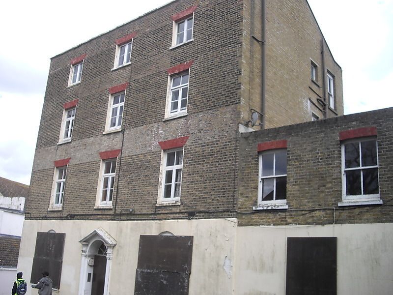
HAWLEY SQUARE
1,
1380
(East Side)
No 19
TR 3570 NE 6/42
II GV
2.
Early C19. 4 storeys brown brick with stuccoed ground floor. Slate roof with
stone coping. 3 altered windows. The ground floor has 2 Venetian type windows.
Central doorcase has an open pediment, pilasters and 6 panelled door.
Extension to the right of 2 storeys.
Nos 19 to 24 (consec) and Nos 26 and 27 form a group
Listing NGR: TR3557770743
External links are from the relevant listing authority and, where applicable, Wikidata. Wikidata IDs may be related buildings as well as this specific building. If you want to add or update a link, you will need to do so by editing the Wikidata entry.


Other nearby listed buildings
